Deal W.E. Handbook To Life In Medieval And Early Modern Japan
Подождите немного. Документ загружается.


LANDSCAPE AND
ENVIRONMENT
Japan is an archipelago in the Pacific Ocean along
the eastern coast of the Asian mainland. The archi-
pelago includes four main islands—Honshu, Hok-
kaido, Kyushu, and Shikoku in descending order of
size—and more than 1,000 other islands of varying
sizes. The total area of Japan is approximately
145,885 square miles, slightly smaller than the state
of California. The four main islands are some 1,200
miles in length (northeast to southwest) with a width
of about 200 miles at the widest point. These four
islands comprise approximately 95 percent of Japan’s
entire landmass.
The Japanese islands are situated at the intersec-
tion of four tectonic plates. The collision of these
plates is the source of the many earthquakes, volca-
noes, hot springs, and other geological phenomena
that have occurred frequently throughout Japanese
history. As a result of this geologic instability, moun-
tains cover some 80 percent of the Japanese land-
scape. Historically, this mountainous land surface
resulted in the division of Japan into regions set into
plains between mountain ranges. Of particular im-
portance during the medieval and early modern
periods are the Kanto Plain—the site of the cities of
Edo and Kamakura—and the Kansai Plain in which
Kyoto and Osaka are situated.
Oceans, Bays, Lakes,
and Rivers
Japan is completely surrounded by water. Thus, rel-
ative to other East Asian nations, Japan exists in geo-
graphical isolation, a feature that has allowed it to
draw upon Chinese, Korean, and other continental
influences when it chose to do so, and to isolate itself
from outside influences at other times. The Sea of
Japan separates Japan from China (500 miles at the
closest point) and Korea (120 miles at the closest
point). The Seto Inland Sea (Seto Naikai), a part of
the Pacific Ocean, creates sea boundaries between
Honshu, Shikoku, and Kyushu. Some 1,000 islands
populate the Seto Inland Sea. This sea and its islands
were significant to trade and transportation during
the medieval and early modern periods. Other ocean
boundaries between the four main islands include
several straits (kaikyo), such as the Kammon Strait
(also called Shimonoseki Strait; located between
Honshu and Kyushu), the Tsugaru Strait (situated
between Honshu and Hokkaido), the Naruto Strait
(at the entry to Osaka Bay), and the Tsushima Strait
(between Iki Island and Tsushima Island in the
Pacific Ocean).
During the medieval and early modern periods,
several bays (wan) served as calm waters for ports
that conducted both domestic and foreign trade.
Among the more significant in this time period were
Osaka Bay, Edo Bay (present-day Tokyo Bay), Ise
Bay, and Uraga Bay.
There are few lakes on the Japanese islands,
though Lake Biwa (Biwako) in central Honshu, Ja-
pan’s largest freshwater lake, is a notable exception.
Lake Biwa (area: 259 square miles; circumference:
172 miles) was fished and used for transportation in
the medieval and early modern periods. Lake Biwa
also secured a place in the Japanese imagination for
its Eight Views of Omi. This refers to eight loca-
tions around Lake Biwa in Omi Province (present-
day Shiga Prefecture) that were praised for their
beauty from at least the beginning of the 16th cen-
tury and were a subject for Edo-period artists.
The Japanese landscape is marked by many
rivers, but most of them are rather short. Only two
rivers, the Shinanogawa and the Tonegawa on Hon-
shu, exceed a length of 200 miles. Historically, rivers
were used mostly for crop irrigation rather than ship
navigation. Flooding also impacted medieval and
early modern life. Some important rivers include:
Ara River (Arakawa; length: 105 miles) Originates
in the Kanto Mountain, ends in Edo Bay (present-
day Tokyo Bay)
Chikugo River (Chikugogawa; length: 89 miles)
Longest river in Kyushu
Edo River (Edogawa; length: 37 miles) Flows into
Edo Bay (Tokyo Bay)
H ANDBOOK TO L IFE IN M EDIEVAL AND E ARLY M ODERN J APAN
54
L AND, ENVIRONMENT, AND P OPULATION
55
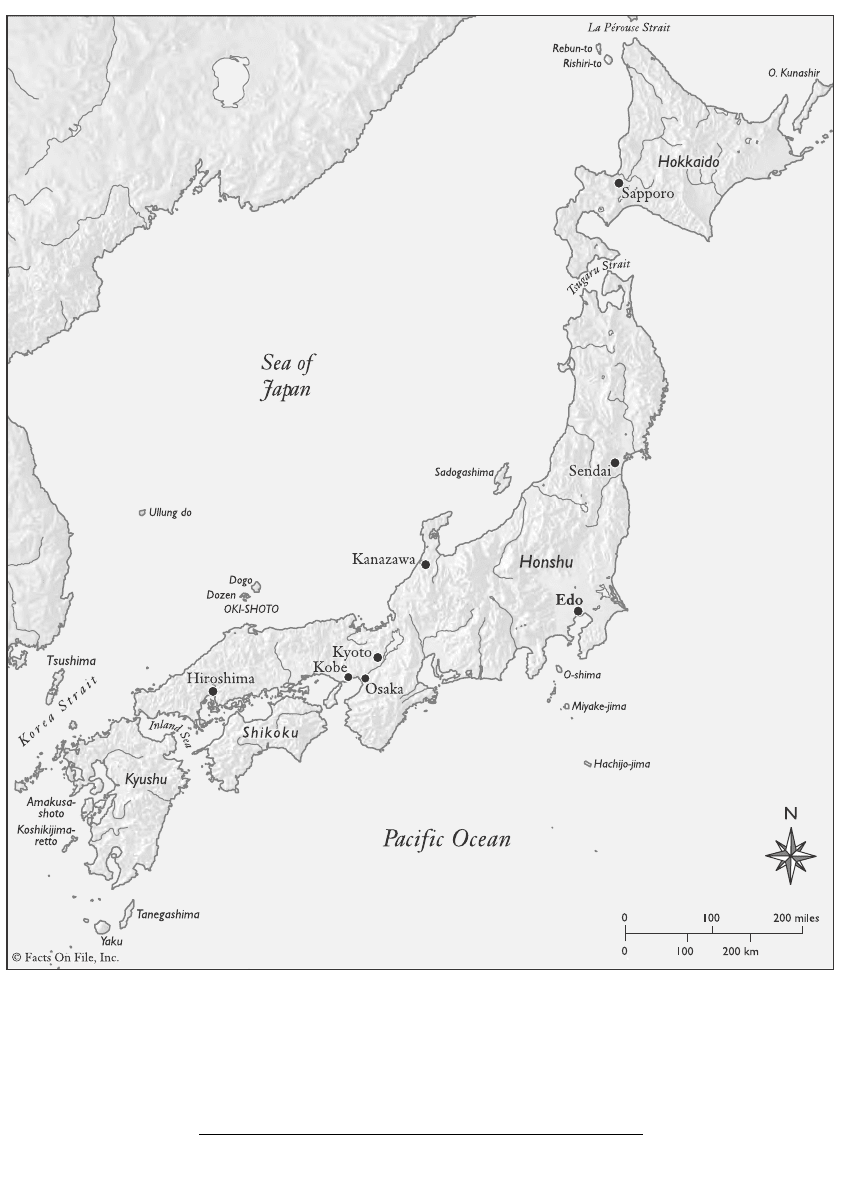
Map 2. Topographic Map of Japan’s Main Islands
Kamo River (Kamogawa; length: 22 miles) Flows
through Kyoto
Katsura River (Katsuragawa; length: 19 miles)
Flows through Kyoto
Kiso River (Kisogawa; length: 141 miles) Honshu;
flows into Ise Bay at Nagoya
Kitakami River (Kitakamigawa; length: 155 miles)
Longest river in the Tohoku region of northern
Honshu
Kuma River (Kumagawa; length: 71 miles) Flows
through Kyushu
Mogami River (Mogamigawa; length: 142 miles)
Flows through the Tohoku region of northern
Honshu
Nagara River (Nagaragawa; length: 87 miles)
Flows through central Honshu and empties into Ise
Bay; famous for cormorant fishing
Oi River (Oigawa; length: 99 miles) Flows through
central Honshu and empties into Suruga Bay
Sagami River (Sagamigawa; length: 68 miles)
Flows through central Honshu and empties into
Sagami Bay
Shinano River (Shinanogawa; length: 228 miles)
Longest river in Japan; flows through central Hon-
shu and empties into the Sea of Japan at Niigata
Sumida River (Sumidagawa; length: 15 miles)
Flows through Edo (Tokyo) as one of the lower
branches of the Arakawa; important in the history of
Edo culture and society
H ANDBOOK TO L IFE IN M EDIEVAL AND E ARLY M ODERN J APAN
56
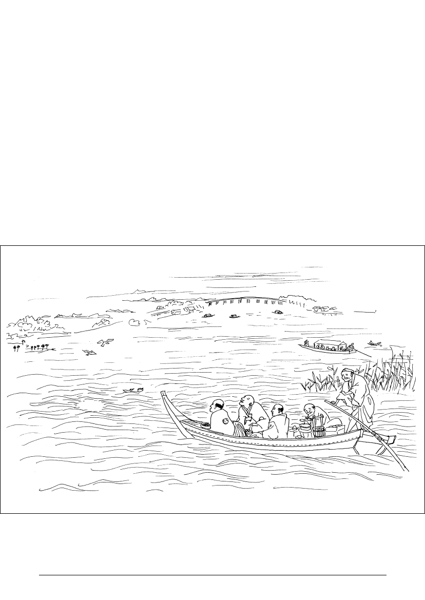
2.1 Leisure-time boating on the Sumida River in the city of Edo (Illustration Grace Vibbert)

Tama River (Tamagawa; length: 78 miles) Flows
into Edo Bay (Tokyo Bay)
Tenryu River (Tenryugawa; length: 132 miles)
Flows through central Honshu
Tone River (Tonegawa; length: 200 miles) Second-
longest river in Japan; flows through central Honshu
and empties into the Pacific Ocean at Choshi; the
Tonegawa originally emptied into Edo Bay (Tokyo
Bay) but in the Edo period the river’s course was
altered to try to prevent floods in Edo
Yodo River (Yodogawa; length: 47 miles) Flows
through central Honshu; it originates in Lake Biwa
and empties into Osaka Bay; at its upper reaches the
river is called the Setagawa and as it flows near
Kyoto it is called the Ujigawa; the Yodogawa was
important in the medieval and early modern periods
as a transportation route between Kyoto and Osaka.
Mountains, Volcanoes,
and Earthquakes
One of the most prominent attributes of the Japan-
ese landscape is the presence of mountains and vol-
canoes. Mountainous, wooded terrain comprises
two-thirds of the Japanese islands, leaving only
about 15 percent of arable land available. The main
island of Honshu is split by mountains that run
down its spine, dividing the island into a side that
faces the Pacific Ocean and a side that faces the Sea
of Japan.
The majority of mountains and volcanoes are a
few hundred to a couple of thousand feet in altitude,
but a few ranges reach 5,000–10,000 feet high. The
highest mountain in Japan is Mount Fuji (Fujisan),
an active volcano extending more than 10,000 feet in
height. Its oft-depicted conical shape represents a
common volcanic form seen throughout Japan. Tra-
ditionally, mountains, such as Mount Fuji, have been
considered the abode of the gods and as such were
considered sacred during the time period studied in
this volume.
Mountains also created natural boundaries be-
tween different parts of Japan that had strategic
implications during the medieval and early modern
periods. They impeded trade and communication,
and made it difficult to fight wars or to uniformly
exert political influence and administer the law.
Because Japan is situated in one of the most geo-
logically active regions of the world, volcanoes and
earthquakes are frequent both historically and today.
Both volcanoes and earthquakes have had a signifi-
cant impact on the lives of the Japanese people
throughout Japan’s history. Destructive volcanic
eruptions and devastating earthquakes are recorded
in the medieval and early modern periods with some
regularity. Earthquakes occurring under the ocean
can spawn large tidal waves known as tsunami. His-
tory records the destructive power of such waves
when they reach the shore. Volcanoes and earth-
quakes occurred with sufficient frequency and inten-
sity that this topographic feature of the Japanese
islands served as a frequent reminder to medieval
and early modern Japanese of the Buddhist notion of
impermanence, the idea of the fundamental instabil-
ity and ephemerality of the world. Positive effects of
this geologic phenomenon include hot springs,
which have traditionally been used both for relax-
ation and for medicinal purposes, a fertile land rich
in mineral deposits, and productive soil.
Some important mountains and volcanoes
include:
Mount Asama (Asamayama; height: 8,425 feet)
Volcano in central Honshu
Mount Aso (Asosan; height: 5,223 feet) Volcano in
Kyushu
Mount Bandai (Bandaisan; height: 5,968 feet)
Volcano in northern Honshu
Mount Dai (Daisen; height: 5,673 feet) Volcano in
western Honshu; home of Daisenji Buddhist temple
Mount Fuji (Fujisan; height: 12,388 feet) The
highest and most famous mountain in Japan; located
in central Honshu; considered particularly sacred
and a symbol of the Japanese nation; subject of liter-
L AND, ENVIRONMENT, AND P OPULATION
57

ature and art; visible from Edo; still classified as an
active volcano although it has not erupted since
1707; as a sacred mountain, Fuji was the object of
pilgrimage during the Edo period—as with other
sacred mountains, women were forbidden to climb it
because they were considered impure
Mount Haku (Hakusan; height: 8,865 feet) Vol-
cano in central Honshu; considered particularly
sacred
Mount Hakone (Hakoneyama; height: 4,718 feet)
Volcano in central Honshu
Mount Hiei (Hieizan; height: 2,782 feet) Moun-
tain to the northeast of Kyoto; the important Tendai
Buddhist temple complex of Enryakuji and the Hie
Shrine are located on Hiei
Mount Koya (Koyasan; height: 3.300 feet) Moun-
tain in central Honshu; home to the important Shin-
gon Buddhist temple complex of Kongobuji;
throughout the medieval and early modern periods
women were forbidden to climb the mountain
Mount Shira (Shirayama; height: 8,865 feet)
Alternate name for Hakusan (see above)
Mount Tate (Tateyama; height: 9,892 feet) Moun-
tain in central Honshu; considered one of Japan’s
three most sacred mountains, along with Mount Fuji
and Mount Haku
Mount Unzen (Unzendake; height: 4,459 feet)
Volcano in Kyushu near Nagasaki
Mount Yari (Yarigatake; height: 10,433 feet)
Mountain in central Honshu; part of the Hida
Mountain range
Climate
The overall climate of Japan is marked by diversity
and fluctuation, though it is generally characterized
as temperate to subtropical and experiences four
seasons. Because of the great length of its north/
south land orientation, Japan resides in several cli-
matic zones and experiences a variety of different
weather conditions. Influencing the climate of Japan
is its location in the monsoon zone of East Asia,
which generates great winds and produces seasonal
shifts. Local variations in climate are the result of
proximity to mountains, oceans, and other geo-
graphic features. The Japanese rainy season pro-
duces an average annual rainfall of 180 inches per
year. Typhoons are a yearly occurrence. Hokkaido,
the northernmost of Japan’s four main islands, has a
climate that is both drier and cooler than the other
three islands.
The winter season is characterized by monsoons
dropping major snowfall on the mountainous
regions of Japan. The spring season brings in
warmer air currents and dry conditions, but this is
soon followed by the rainy season (baiu) in June and
July. The summer season that follows produces hot
and humid weather, especially in the plains areas.
Summer is brought to an end by the yearly typhoons
in August and September, the end of which marks
the start of the autumn season. The fall is also distin-
guished by continued rain, and cooler, breezier
weather, finally ending with the beginning mon-
soons of winter.
Natural Resources
Natural resources in the Japanese islands include its
abundant forests and supply of wood. More than 70
percent of Japan is wooded, and the islands are home
to a variety of tree species throughout its varied
regions. During the Edo period, Japan experienced a
great demand for wood to build the infrastructure of
its newly emerging urban centers, such as Edo and
Osaka.
Mining has been prevalent throughout Japanese
history. In particular, during the 16th to the 18th
centuries, a number of gold and silver mines were
opened, including the famous Sado Island mines.
These mines produced tremendous amounts of gold
and silver, which aided the income of the Tokugawa
shogunate.
H ANDBOOK TO L IFE IN M EDIEVAL AND E ARLY M ODERN J APAN
58
Flora and Fauna
Japan is home to a rich variety of plant and animal life.
Flora and fauna are used for food, medicine, and other
specific needs of daily life. Bamboo, for example, is
used both in construction and, as young shoots
(takenoko), for food. Plants and animals also have asso-
ciations with the seasons and other symbolic mean-
ings. Plant and animal motifs are used on traditional
clothing and family crests, and certain plants are used
in Japanese religious and seasonal rituals. For instance,
pine is used at the New Year and symbolizes longevity.
The varied climates of Japan have produced a
diverse array of plant life throughout the archipel-
ago. Different regions are notable for different
botanical characteristics. Overall, it is estimated that
Japan has approximately 5,000–6,000 different plant
species. During the Edo period, floriculture thrived,
giving rise to the development of numerous new
species of wildflowers. Similarly, Japan has a signifi-
cant diversity of animal and sea life. There are more
than 110 different kinds of mammals resident on the
Japanese islands. Besides the fish and other sea life
found in Japan’s ocean waters, there are various species
of seaweed, some of which are harvested for food.
L AND, ENVIRONMENT, AND P OPULATION
59
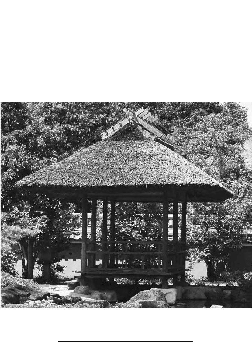
2.2 Example of the use of thatch in roof construction (Photo William E. Deal)
CITY, TOWN, AND
COUNTRYSIDE
The rise of cities and towns in Japan during the
medieval and early modern periods occurred espe-
cially with the development of castle and market
towns, though temple and port towns also played a
role in urban development. This urbanization process
largely took place in the Edo period, although its ori-
gins date back to the medieval period. Exceptions to
this general pattern during the medieval period were
cities such as Kyoto and Kamakura that developed
into flourishing cities due to their position as either
imperial or shogunal capitals.
Castle Towns
Castle towns trace their origin to the Muromachi
period and the construction of wooden defenses typ-
ically located on hills for reasons of protection and
surveillance. These fortifications were the precur-
sors to the castles and castle-building styles that
grew more elaborate during the Warring States
period. As the military and political significance of
castles grew, they also became the focal point for
economic activity within their local region. With the
rise of commerce around castles, merchants, arti-
sans, and peasants joined the warrior class in taking
up residence within a castle’s sphere of influence.
Castles became castle towns as a result. By the
Azuchi-Momoyama period (late 16th century), cas-
tle towns became the political and administrative
H ANDBOOK TO L IFE IN M EDIEVAL AND E ARLY M ODERN J APAN
60
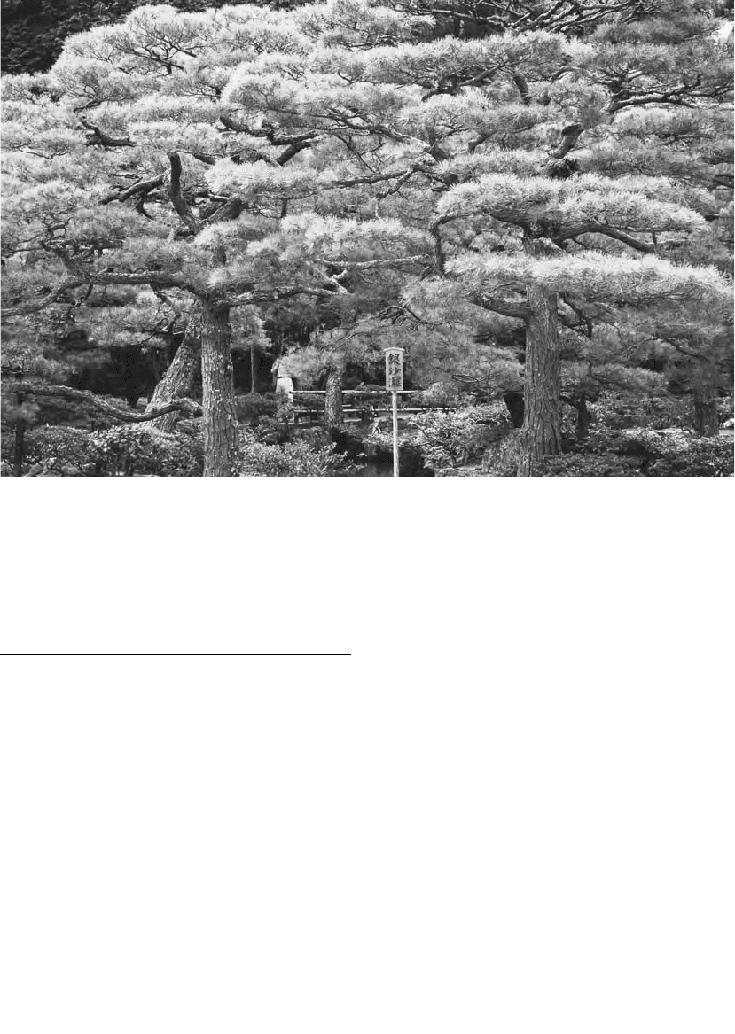
2.3 Black pines at the Ginkakuji in Kyoto (Photo William E. Deal)

hubs of daimyo domains, and it is estimated that in
most domains one-10th of the population resided in
its castle town. Some of them, at least, were to
become Japan’s largest cities, such as Edo and Osaka.
During the 16th century, castle towns (joka
machi) began their transformation into town and city
complexes. This occurred in part because castle
towns served as government administration centers.
Many daimyo and almost all samurai lived within
the castle town complexes. Merchants, traders, arti-
sans, craftspeople, and others were eventually incor-
porated into these towns and cities to provide the
labor and market activity needed to support the
work conducted there and to further build and
maintain the infrastructure. As a result of this
dynamic, castle and market towns came to occupy
the same location.
Market Towns
Market towns (ichiba machi) originated in the
Kamakura period as areas the government autho-
rized to sell produce and other goods on certain days
of the month. As the population density of castle
towns increased, markets assumed locations either
nearby or within castle towns. Some merchants also
became residents of cities while others traveled from
market to market. Historically market towns repre-
sented the confluence of both rural and urban life.
As city and town populations increased, market
shops open on a regular basis came to largely sup-
plant the need for the earlier periodic markets.
Temple/Shrine Towns
Temple and shrine towns (monzen machi) originated
in the vicinity of Buddhist temples and Shinto
shrines, usually along the roads leading to these reli-
gious sites. These towns served the needs of pilgrims
visiting the temples and shrines. Establishments that
developed along these routes provided food and lodg-
ing to pilgrims, and sold amulets and other religious
items. As religious sites grew in size, so did the per-
manent infrastructure needed to support this activity.
Port Towns
Port towns grew up around sea ports that developed
flourishing trading centers in the medieval and early
modern periods. The cities of Anotsu, Bo no Tsu,
Hakata, and Sakai (for details on these cities, see
below) are examples of cities that developed from
trade with the Asian mainland. Even after restric-
tions on foreign trade were enacted by the shogu-
nate in the 16th century, ports engaged in domestic
trade continued to thrive.
Post-Station Towns
Post-station towns (shukuba machi or shukueki) grew
up along the medieval and early modern road sys-
tems that connected cities and towns to each other.
Post stations were sometimes small towns that pro-
vided basic provisions and lodging to travelers.
L AND, ENVIRONMENT, AND P OPULATION
61
2.4 Dragonfly (tombo) on a bamboo fence rail—one of
many kinds of insect life native to Japan
(Photo William
E. Deal)

Other post stations developed into substantial cities,
usually as a result of their location in or near a mar-
ket, or as a result of their location along the intersec-
tion of two or more roads. Post-station towns were
regulated by the government. For additional details
on post-station towns see chapter 11: Travel and
Communication.
Countryside
The historical record concerning rural habitation in
medieval Japan is often lacking in precise informa-
tion. Details emerge more clearly after 1600. In gen-
eral, medieval and early modern rural inhabitants
lived within a village context. The village operated
as a communal support for the overall well-being of
the community. Everyone associated with the village
was dependent on the development of the agricul-
tural community as a whole. Typically, villages pro-
duced rice, grain, and other field crops. There were,
of course, significant local variations in the way that
rural communities were set up and the degree to
which the terrain—for instance, flat land or hills—
dispersed people or drew them together.
Village settlement began to change with the
advent of large cities—like Edo and Osaka—and the
increasing importance of castle towns as centers of
commercial activity during the early modern period.
The capriciousness of farm life with its uncertain
harvests was sometimes abandoned for the draw of a
town or city and its allure of steadier employment.
Besides farm villages, fishing villages were a feature
of medieval and early modern rural life, and moun-
tain villages developed in the early modern period
around lumber and other products that found flour-
ishing markets in the expanding towns and cities of
the Edo period.
Domains
Domains (han) were territories assigned by the
Tokugawa shogunate and governed by provincial
daimyo. The term han refers to both the land itself
and the provincial governments that the various
domains represented. Domains were provincial cen-
ters for administrative, military, and financial gover-
nance that provided both local control and
connections to the shogunate in Edo. The number
of domains fluctuated during the Edo period. Gen-
erally, though, there were about 260 domains in
existence at any given time. The rise and fall of a
particular domain was usually the result of either
internal conflict or the intervention of the Tokugawa
government. The shogunate would, for instance, re-
assign domain control when it feared possible
provincial rebellion.
Daimyo domains varied in size, bureaucratic
structures, and the extent of their autonomy from
direct control by the Tokugawa shogunate. Gener-
ally, the greater the distance from Edo, the greater
was the independence. Domains also had different
rice-producing capacities. Depending on size, do-
mains produced anywhere from 10,000 to 1 million
koku (one koku = five bushels or 180 liters) of rice a
year.
Having been awarded a particular domain, a
daimyo was required to fulfill certain obligations to
the shogunate. These responsibilities included the
creation and upkeep of a local army of samurai loyal
to the shogun, and compliance with the system of
sankin kotai, whereby each daimyo was required to
reside every other year in Edo in attendance on the
shogun.
POPULATION
STATISTICS
Total Population
Population expanded throughout Japan’s early mod-
ern period. Such expansion was most notable in the
17th century where the overall population rose from
12 million to 30 million, although these numbers
decreased and eventually leveled off during the 18th
century. The statistics listed below for Japan’s total
population were gathered from population censuses
H ANDBOOK TO L IFE IN M EDIEVAL AND E ARLY M ODERN J APAN
62

conducted at the order of the shogunate. However,
the accuracy of such statistics varies greatly, as the
surveys often neglected different demographics like
members of the samurai household, children, and
others.
Year Population
1721 26,065,425
1732 26,921,816
1744 26,153,450
1756 26,061,830
1780 26,010,600
1792 24,891,441
1804 25,517,729
1828 27,201,400
1834 27,063,907
1846 26,907,625
Source: Conrad Totman, Early Modern Japan (Berkeley:
University of California Press, 1993): 251.
Urban Population
In 1700, around 5 to 7 percent of the populace re-
sided in larger cities, making Japan one of the most
urbanized countries in the world in this time period.
Between 1550 and 1700 Kyoto was the first city to
surpass a population of 100,000 people. By 1700 the
city was estimated to have approximately 350,000
individuals. Osaka had roughly 500,000 people in
the mid 18th century, dropping to 375,000 in 1801
and 317,000 in 1854. While Edo began as a village,
by 1678 it grew to roughly 570,361 inhabitants. This
number increased to about 1.3 million in 1721 and
1.4 million by the start of the 19th century. These
statistics made Edo one of the largest urban centers
in the entire world at the time.
GAZETTEER OF
PLACE-NAMES
Islands
CHIKUBUSHIMA
Chikubushima (area: .05 square miles) is an island
located in Lake Biwa in central Honshu. It is consid-
ered a sacred island and is the site of both the Ho-
gonji temple and the Tsukubusuma Shrine. Hogonji
is also the 30th of the 33 temples that comprise the
L AND, ENVIRONMENT, AND P OPULATION
63
2.5 Model of a crowded amusement area (sakariba) in the city of Edo (Edo-Tokyo Museum exhibit; Photo William
E. Deal)