Fisher G. Between Empires. Arabs, Romans, and Sasanians in Late Antiquity
Подождите немного. Документ загружается.

Arabia in the fourth and fifth centuries, and Robin suggests that the
term Tanūkh was used by the H
˙
imyarites to describe al-H
˙
īrah. There
is a possible, but debatable, connection between the Gadimathos
possibly connected with Tanūkh from the Umm al-Jimāl inscription,
above, and a Jadhīma al-Abrash, connected to al-H
˙
īrah and the
Nas
rids in the later Muslim Arabic tradition. The confusion over
exactly which tribe was under Nas
rid control at and around al-
H
˙
īrah—especially if Lakhm was based further west, if a link between
Imruʾ l-Qays and Lakhm is to be preferred—warns us against making
any judgement over the existence of a homogeneous ‘Lakhmid’ state.
Like the terms Ma add, Mud
˙
ar, and Ghassān, it is impossible to know
what number of other allied or subect peoples might be included
within these broad designations.
78
In common with the Jafnids, it is only in the late fifth and early
sixth centuries that the Nas
rids appear in a significant way in con-
temporary literary sources, primarily through the problems caused by
al-Nu mān at the turn of the century, the attacks of al-Mundhir, the
role of his descendant, Amr (Ambrus), in negotiations with the
Roman Emperor Justin II, and the apparent Christianisation and
death of another al-Nu mān, the final Nas
rid leader.
79
The likely
reason for this is the emergence of the Jafnid leaders in the west at
about the same time, and the ongoing state of competition and
warfare between the Empire and the Sasanians which favoured an
increased emphasis on the allies of the two.
80
The degree of political and economic development among the
Nas
rids and those over whom they ruled is suggested by a number
of factors. Al-H
˙
īrah’s location favoured caravan traffic, with links to
the lucrative Red Sea and Persian Gulf spice and silk markets. As
mentioned above, al-T
˙
abarī suggested that the Nas
rid al-Mundhir
was in control of Bah
˙
rain and Yamāma on behalf of the Sasanians,
following the death of al-H
˙
ārith the H
˙
ujrid, placing him in nominal
control of Persian Gulf trade routes. There is also the suggestion in Ry
506 that the Nas
rids were active with regard to Ma add, in central
Arabia, and it is possible as well that they sought an alliance with
78
Robin, ‘Les Arabes de H
˙
imyar’, 181–2, 190.
79
Al-Nu mān: Theoph. Chron. 141; al-Mundhir: Malalas, Chron. 434–5, Proc. BP
2.16.17, 19.34, and 28.12–14; Amr: Menander fr. 6.1; on al-Nu mān, Chron. Seert (PO
13, 468–9); Evag. HE 6.22.
80
Cf. the increased reference to H
˙
imyar and Axum during this period, most
probably for the same reasons.
92 Empires, Clients, and Politics
Yathrib (Medina). This is especially interesting, in that there is some
speculation that the Jafnids may have tried to gain an economic
foothold in Mecca.
81
It is plausible to see within this general picture
the Nas
rid leadership attempting to enlarge their activities in Arabia,
profiting from superpower competition in the region. Other revenues
may have come from plunder and booty, and it is also thought that
the Nas
rids were able to retain some of the tax from estates and
regional populations under their control.
82
Political development seems to have been connected to Sasanian
policy, although at a certain point started to become detached from it.
Through the Nas
rids, the Sasanians tried to extend their influence
into Arabia; Arabs under Nas
rid control also accompanied Sasanian
forces on operations in Syria and Mesopotamia. Yet in these in-
stances, Arab allies of the Sasanids displayed a steadily increasing
independence of action, and Nas
rid leaders could also be seen at-
tempting to influence the Sasanian king himself, even if under the
pretence of a common set of goals.
83
Nas
rid enmity towards the
H
˙
ujrids and, later, the Jafnids, also began to take place more and
more outside of imperial control. Whilst the supposed dynastic links
between the H
˙
ujrids and Nas
rids seem to have originated from a
position of H
˙
ujrid superiority, the accession of the vigorous and
energetic leader al-Mundhir and the death of the H
˙
ujrid al-H
˙
ārith
during the early years of al-Mundhir’s leadership tipped the balance
of power in favour of the Nas
rids, a factor, perhaps, in the apparent
control over Ma add enjoyed by the Nas
rids during this period.
84
The growing political influence of the Nas
rids under al-Mundhir is
apparent in his receipt of an embassy from Dhū Nuwās, looking
for support in connection with anti-Christian activities at Najrān
in Arabia.
85
The Marib dam inscription from H
˙
imyar records an
embassy of the Nas
rids to Abraha, and the presence of Amr on
81
Donner, ‘The background to Islam’, 516, discussing Kister, ‘Al-Hira’, 144–9,
Bosworth, ‘Iran and the Arabs’, 600–1.
82
F. M. Donner, The Early Islamic Conquests (Princeton, 1981), 47.
83
Josh. Styl. Chron.58;cf.Howard-Johnston,‘State and society’, 123, discussing
Sasanian attempts to ‘suborn’ tribes under Jafnid influence. It is very likely that any such
attempts would have depended on the Lakhmids, hinting at the occasional alignment
between Lakhmid ‘policy’ and Sasanian ‘interests’.
84
Robin, ‘Royaume H
˙
ujride’, 669; Olinder, Kings of Kinda, 58.
85
Zach. Rhet. HE.8.3.
Empires, Clients, and Politics 93
diplomatic missions to Justin II indicates a growing diplomatic role
for the Nas
rid leaders, which is dicussed in more detail below.
86
Despite the increasing independence of action which characterises
later Nas
rid leaders, it is unlikely that the sources of revenue or the
political and diplomatic opportunities taken by the Nas
rids would
have been as accessible without the consistent support provided by
the Sasanian leadership. Unlike the territory of Ma add, the Nas
rid
base was located in close proximity to the seat of Sasanian power, yet
comparisons with the H
˙
ujrids are illuminating. The Nas
rids took part
in the wars of the Sasanians against Rome and seem to have acted as
their agents in Arabia and the Gulf. The Nas
rid leadership was also a
multi-generational dynasty maintained at least in part through the
tolerance of the empire which patronised it. Sasanian support was
probably a key component in the longevity of the Nas
rid dynasty and
the source of many of its opportunities to extend its power.
Even whilst ‘part’ of the Sasanian Empire, the Nas
rids fostered a
noticeable political identity, and this, alongside their maintenance of
their stable base at al-H
˙
īrah, contrives to make the Nas
rids the most
state-like group of the Nas
rids, Jafnids, and H
˙
ujrids. Little is known of
any stable Jafnid ‘base’, and there are conflicting reports of where
exactly any descendants of H
˙
ujr exercised their power.
87
Unfortu-
nately, as well, little is known of al-H
˙
īrah, other than the sparse
archaeological evidence, but its celebrated place in Muslim tradition
as a centre for pre-Islamic poetry,
88
and the traditional attribution of
the construction of al-Khawarnak—a desert castle or retreat
89
—to the
Nas
rids, held in awe by Muslims at the time of the seventh-century
invasions, points towards a flowering and distinctive culture inside
the borders of a late antique superpower state which supported and
protected its leading dynastic family.
90
Traditions concerning its
army, court, and other familiar aspects of state-like entities, whilst
provided by much later sources, also suggest that the Nas
rids should
be placed apart from the Jafnids and the H
˙
ujrids. Certainly their
relationship with the Sasanians was far longer-lived than that between
86
CIS 4. 541; Hoyland, Arabia, 55; Smith, ‘Events in Arabia’, 440.
87
Robin, ‘Les Arabes de H
˙
imyar’, 187, 193.
88
Poetry, language, and culture will be discussed in more detail in Ch. 4.
89
On al-Khawarnak, see further Ch. 6.
90
D. Talbot Rice, ‘The Oxford excavations at Hira, 1931’, Antiquity, 6 (1932), 276–91,
at 277; also ‘Hira’, 257.
94 Empires, Clients, and Politics
the Romans and the Jafnids or H
˙
ujrids,
91
and it was this ongong
support which probably helped to develop the Nas
rid principality at
al-H
˙
īrah into a state-like entity capable of acting within a large,
centralised, and well-organised empire.
THE JAFNIDS AND GHASSĀN
For the Jafnids, we can take advantage of the greater evidence for their
activities in the sixth century, such as their involvement in the eco-
nomic and political life of the Empire, as well as their involvement in
ecclesiastical matters, to examine the ways in which they produced an
identifiable and developing political ‘entity’ within the Roman Empire
but, at the same time, managed to remain somewhat detached from it.
As discussed in Chapter 1, the manner in which the Jafnids came into
contact with the Roman Empire is not well understood. Muslim Arab
sources suggest that Ghassān moved into Syria, displacing those who
were already there and who already enjoyed some sort of treaty relation-
ship with Rome.
92
In the Kitābal-mūh
˙
abbar of Ibn H
˙
abībandthe
Taʾrīkh of Ya qubi, for example, a power struggle between Ghassān
and another tribal group, Salīh
˙
, following a movement of Ghassān
northwards into Syria, resulted in the Romans choosing Ghassānas
their preferred allies and concluding a treaty of mutual support.
93
Inter-
estingly, these passages suggest that Salīh
˙
were in a ‘management’ posi-
tion over a number of other Arab tribes on behalf of the Romans,
including Mud
˙
ar, a duty which included the collection of taxes. There
is no contemporary evidence for this, but the sense of these passages is
consistent with the general picture of an increased level of contact
between the Romans and the Arabs in Syria and northern Arabia and
91
Cf. Robin, ‘Les Arabes de H
˙
imyar’, 191–3.
92
It is tempting to connect this disturbance in southern Syria with that reported by
Theophanes for the turn of the sixth century: Theoph. Chron. 141; cf. Evag. HE 3.36;
Shahid, Fifth Century, 120–33.
93
Ibn H
˙
abīb, 370–71; Ya qubi, 233–5, translated by Hoyland, Arabia, 239–40.
This episode also features in H
˙
amza al-Is
fahānī, Taʾr īkh,98–9, discussed by Shahid,
Fifth Century, 285. The presence of Salīh
˙
within or on the edges of the Roman
Empire is inferred by Sartre, Trois études, 148, a connection also made by Shahid,
Fifth Century, 243.
Empires, Clients, and Politics 95
their incorporation into formal or semi-formal administrative arrange-
ments.
While the exact details of the first contacts between Rome and the
Jafnids are not precisely known, the Jafnids would eventually become
the principal allies of the Roman Empire in the sixth century. Al-H
˙
ārith
would be the first to receive a significant level of imperial recognition in
528/9, but he was probably not the first member of the Jafnids to
become involved with the Empire and was not the only one to be
employed by it. Abu Karīb, probably his brother,
94
appears accom-
panying al-H
˙
ārith to Marib in 548, and well before that al-H
˙
ārith’s
father, Jabala, appears as a participant in the same military disturbance
at the turn of the sixth century reported by Theophanes. Apparently
the first Jafnid to make an agreement with the Romans, Jabala also
appears in a letter from Simeon
95
as ‘king of the sny’ (possibly Ghas-
sān),
96
in connection with a place called Gabītā,probablyJābiya, which
would go on to enjoy a long association with the Jafnids.
97
After these early contacts, the critical boost for the development of
Jafnid power was the elevation of al-H
˙
ārith to a position of direct
imperial patronage under Justinian. Procopius relates that Justinian
was frustrated by the inability of his commanders as well as local
phylarchs to curb the troublesome raids of the Nas
rid leader al-
Mundhir, and saw an opportunity to tackle the problem through an
extension of his support to al-H
˙
ārith (c.530).
98
Justinian probably did
not have the ability or will to either rule or influence Arab tribal
groups directly, and it made sense to follow standard Roman practice
and pick an individual who was already well respected locally with the
potential to maintain or further build up his position. Here, Justinian
chose someone who seems to have already been a phylarch and gave
him what Procopius enigmatically calls the ‘dignity of king’ (IøÆ
Æغø), presumably an honorific of some kind, and probably some
funding, to enable him to build up his position.
99
Such arrangements
would have allowed al-H
˙
ārith to stand out from other potential Arab
94
Ch. 2 n. 71, above.
95
Of Bēth Arsh ām; see Ch. 2 n. 138.
96
This identification is favoured by Hoyland, ‘Late Roman Provincia Arabia’, 118.
97
I. Shahid, The Martyrs of Najrân, 63.
98
Proc. BP 1.17.46.
99
Ibid. 1.17.47.
96 Empires, Clients, and Politics
leaders, placing him extremely close to the power of the Roman state,
as represented by the figure of the Emperor.
100
It seems as if the Jafnids were emerging as powerful individuals at the
beginning of the sixth century, and certainly this view is supported by the
course of events which followed.
101
The presence of a pre-existing family
lineage in good standing is consistent with indications that al-H
˙
ārith was
already a local figure of some significance,
102
a fact which is equally
consistent with Roman policy, which sought to develop relationships
with powerful individuals. This is underscored by the report of Justi-
nian’s actions in Procopius, as well as by an Arabic graffito from Jebel
Seis, a site in the desert south-east of Damascus. Dating to 528/9, just
before al-H
˙
ārith was elevated, its honorific ʾl-Hrth ʾl-mlk, ‘al-H
˙
ārith the
king’, stands as a testament to the respect accorded to al-H
˙
ārith locally,
and bears comparison with the use of mlk at Nemāra and Ruwwāfa and
in the reference to H
˙
ujr as mlk kdt. Here it is similarly unclear how much
weight should be accorded to the term mlk beyond its value for internal
consumption.
103
In any case, it seems certain that the rise of the Jafnids
as a state-allied political dynasty was built on pre-existing local leader-
ship as well as a pre-existing family agreement with Rome.
104
From Justinian’s perspective, the Nas
rid al-Mundhir had demon-
strated that his unpredictable and swift incursions could cause serious
and occasionally embarrassing problems; in 524, he had managed to
capture two Roman generals, who were only recovered through a
100
Robin, ‘Les Arabes de H
˙
imyar’, 184.
101
Theoph. Chron. 141, 144; cf. the report in Evag. HE 3.36; Sartre, Trois études,
158–60; most recently, Haarer, Anastasius,33–7, suggesting that both Kinda and
Ghassān were involved.
102
Precisely how he obtained this standing is unknown, although we can point to
the actions of his father, Jabala, and the possibility that the disturbances of c.500
helped the Jafnid family gain prominence. Hypothetical parallels might be drawn with
other barbarian groups in the Empire, whereby the emergence of powerful dynasties
probably involved the defeat and suppression of other ambitious ruling families. Like
the Amals, al-H
˙
ārith and Jabala were just one of several possibilities; cf. P. Heather,
‘Cassiodorus and the rise of the Amals: genealogy and the Goths under Hun domina-
tion’, JRS, 79 (1989), 103–28, at 126–7, esp. 127: ‘Amal preeminence was created by
[Valamir’s] victories and those of his nephew ...and never in practice rested on
anything other than practical success. ’ The same might be suggested of the Jafnids
prior to the events of 527/8.
103
The Jebel Seis inscription is discussed in some detail in the following chapter,
with complete references.
104
Cf. Beck, ‘Iran and the Qashqai’, 298, noting that the central government’s
recognition of Qashqai khans ‘almost always coincided with internal recognition of a
paramount leader’.
Empires, Clients, and Politics 97
diplomatic mission.
105
Beyond the risk presented by al-Mundhir, Justi-
nian probably also saw a useful opportunity, alongside his initiatives
with Axum, H
˙
imyar, and the H
˙
ujrids, to frustrate Sasanian ambitions
through a calculated interference in Nas
rid activities on the fringes of
Roman territory. In this respect, the Jafnids presented an opportunity to
turn Arab allies against Sasanian interests in a different, eastwards sphere
in conjunction with efforts towards the south, which were conducted
using the H
˙
ujrids or perhaps the leaders of Mud
˙
ar.
106
Whatever the
precise motivation, the recognition accorded to the Jafnids by Constan-
tinople provided them with a consistent degree of extremely influential
political backing. This probably helped to raise their stature with relation
to other Arab groups in the region, although it is not at all clear how
many or whom the Jafnids controlled or how far, beyond the frontiers of
the Empire, their influence carried weight.
107
Over time, the Jafnids grew
in prominence, power, and influence, visiting the capital and receiving
Roman titles. In line with standard Roman policy, they also received
subsidies with which to maintain their power through the redistribution
of wealth and the ability to finance various projects to maintain their
status and position.
108
It is likely that some of this money was also used to
hire troops, enlarging their capabilities further and indicating, perhaps,
that they had grown beyond their immediate power base.
109
At the same
time, they were able to take advantage of other opportunities to pursue
more independent initiatives which might further enhance their personal
position, and that of the other peoples who made up the Arab allies of the
Romans who fought under Jafnid leadership.
Whether or not such peoples included Ghassān, commonly asso-
ciated with the Jafnids, is very much open to debate: clearly there were
people who fought in campaigns such as that at Callinicum under
Jafnid leadership, or who mobbed the city of Bostra after al-Mundhir
was arrested. It is not known precisely who these people were or
105
Zach. Rhet. HE. 8.3; Mundhir launched an attack as far as Syria Prima in 528,
recorded by Malalas, Chron. 445.
106
Robin, ‘Les Arabes de H
˙
imyar’, 181.
107
Cf. ibid. 180.
108
Joh. Eph. HE 176 (3.3.42) with reference to the ‘revolt’ of 581, and describing
the withdrawal of such subsidies; also, Nov. Theod. xxiv, 2 (12 Sept. 443), one of the
few pieces of direct evidence for subsidies paid to Saracen allied troops. The law
cautions duces against skimming off the annona given to the Saracen soldiers. See
Isaac, Limits, 245.
109
Cf. Hoyland, ‘Arab kings, Arab tribes, Arabic texts’, 394–5; Joh. Eph. HE 282
(3.6.3) once again, on al-Mundhir’s efforts to hire troops with gold.
98 Empires, Clients, and Politics
where they came from, although there are several possibilities.
110
Whoever those under Jafnid leadership were, however, comparative
evidence from the barbarians in the west as well as the history of
state–tribe relationships in the Near East points to the distinct pos-
sibility that major changes in the society and politics of the Jafnids, as
well as their ‘people’, would have occurred as a result of the close
interface between the Jafnids and the Roman Empire. In the absence
of any evidence for the wider population, it is worth examining the
activities of the Jafnids since, by the time that al-Mundhir came under
imperial suspicion in the 570s, he had become a successful leader who
managed to bridge the two disparate but connected worlds of steppe
and desert, and the settled Empire. The Jafnids did not produce a
state, yet the emergence of some state-like features related to the
Jafnids demand an explanation; and the most likely reason is, in my
view, the encapsulation of the Jafnids by the Roman Empire which
positioned them ‘in-between’ the state, and the tribe.
111
DAMASCUS AND H
˙
AURĀN
Evidence from the H
˙
aurān and the area around Damascus provides a
number of clues to the evolving regional power of the Jafnids. Muslim
sources such as Hamza al-Is
fahānī (d. after 349/961) and Yāqūt (d. 626/
1229) typically identified numerous sites within and around the H
˙
aurān,
south of Damascus, as ‘Ghassānid’, including the putative base of the
Jafnids at Jabiya. Attempts to match the majority of these sites with
verifiable locations on the ground have proved both contestable and
inconclusive.
112
Contemporary literary and epigraphic evidence, how-
ever, provides some means of assessing the Jafnid presence in an
agricultural and economic heartland of significant cultural diversity,
110
Cf. the analogy with Shammar, ch. 1 n. 10. Cf. Robin, ‘Les Arabes de H
˙
imyar’,
191: ‘Quant aux Jafnides, ce n’est pas sur une tribu (et certainement pas sur Ghassān)
qu’ils ont autorité, mais sur une partie des Arabes du territoire byzantin, apparem-
ment fragmentés en une multitude de groupes tribaux de tailles diverses.’
111
Cf. Salzman, ‘ Why tribes have chiefs’, 282.
112
These authors are discussed by Shahid, Sixth Century, ii/1, 306–46, esp. 312–41,
and Sartre, Trois études, 178–88, where attempts are made (particularly in the latter)
to identify the sites. For a secure rebuttal, see Genequand, ‘Some thoughts’, 78; also
Foss, ‘Syria in transition’, 251.
Empires, Clients, and Politics 99
showing how participation in the affairs of the Empire underlined the
development of an identity based around imperial encapsulation.
The geography and topography of the H
˙
aurān favoured a combi-
nation of agriculture, the pasturage of animals, and intensive settle-
ment. In common with the Belus massif region of northern Syria, the
H
˙
aurān participated in the economic prosperity of the fifth and sixth
centuries.
113
Alongside the appearance of closely packed villages lay a
parallel growth in agriculture, where the expansion of settled farming
tested the limits of what the land could support in an effort to provide
for the local population.
114
The region and its environs show wide
variability in the size and type of settlements, with larger houses
found in the west, and those with cruder ornamentation and decora-
tion typically found in the east.
115
One of the more interesting varia-
tions, in the villages of Batanea, will be considered below; the sites
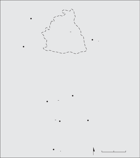
discussed here are shown in Map 5.
At al-H
˙
ayyat, just north of the town of Shaqqā, east of the Lejā in
the heart of the H
˙
aurān and at the north end of Jebel Druze, a
building inscription was found in situ at a substantial two-floored
house, dating to 578 and offering an explicit acknowledgement of al-
Mundhir’s regional authority. The inscription states that the house
was built by one Flavius Seos, Kæ[], ‘administrator’ or ‘trustee’,
and that he and his son (Olbanos) constructed the house ‘in the time
of al-Mundhir’, Kd F Æıç[ı] ºÆıæı Ææ[ØŒı].
Note too al-Mundhir’s designation as patrikios.
116
The house was organised around a central courtyard leading off to
numerous rooms, and was the largest in the town visited by Butler in
1904–5.
117
Al-Mundhir’s appearance on an inscription of this type, at
113
The classic work on the Belus massif was produced by Tchalenko, Villages
antiques de la Syrie du nord, but his conclusions have been comprehensively re-
evaluated and updated by Tate, Les campagnes de la Syrie du nord, and the excavations
at Déhès carried out by Sodini and Tate. For the geography and topography of the
H
˙
aurān, see the thorough treatment by F. Villeneuve, ‘L’économie rurale et la vie des
campagnes dans le Hauran antique (I
er
siècle av. J.-C.–VII
e
siècle ap. J.-C.): Une
approche’, in J. M. Dentzer (ed.), Hauran I: recherches archéologiques sur la Syrie du
Sud à l’époque hellénistique et romaine, 2 vols (Paris, 1985), i, 63–136, at 67–71; also by
the same author, ‘L’économie et les villages, de la findel’époque hellénistique à la fin
de l’époque byzantine’, in J. M. Dentzer and J. Dentzer-Feydy (eds.), Le djebel al- Arab
(Paris, 1991), 37–43; Foss, ‘Syria in transition’, 245–6, 248.
114
Villeneuve, ‘L’économie’, 64.
115
Foss, ‘Syria in transition’, 247–8.
116
Wadd. 2110.
117
PAES 2A, 362–3.
100 Empires, Clients, and Politics
a wealthy dwelling in one of the most important agricultural regions
of Roman Syria, is a strong argument for the integration of the Jafnid
elite into the local community. The house is also quite interesting in
that the ground floor court does not seem to be suitable for the
stabling of animals, a typical feature of domestic structures in the
region. This suggests that the owners’ wealth may have been derived
from other sources, perhaps trade or landownership. It is not possible
to be sure, but the divergence of the house plan from the normal
pattern found in the region (Foss describes it as resembling ‘the inner
Kafr Shams
Nawa
BATANEA
al-Hayyat
BOSTRA
Samma
Umm al-Jimal
Umm al-Quttein
JEBEL DRUZE
Qasr al-Hallabat
N
0
20km
AL-LEJA
,
Map 5. The H
˙
aurān and surrounding areas, indicating sites discussed in the
text.
Empires, Clients, and Politics 101