Japanese National Committee on Large Dams. Dams in Japan, No. 10
Подождите немного. Документ загружается.

14.
KUSAKI
DAM
Location
Nearest
City .
River
Purpose
.......
Catchment
area
Mean
annual
discharge
Years
of construction
.
Type
Foundation
Height
Crest
length
Volume
Spillway
Type
Type and
number
of
gate
..
Maximum
discharge
capacity
Reservoir
Gross capacity
Effective
capacity
Area
Drawdown
range
Owner
Engineering
by
Construction
by
Azuma-mura,
Sata-gun,
Gunma-ken
Kiryu-shi
Watarase
Flood control,
Maintenance
of
normal
supply and Hydroelectric
54km2
11.7m3ls
197t-1.976
Gravity
Slate, Chert
and
Sandstone
140m
405m
1,,300,000m,
Controlled
Crest
radial
gate
X
4 and
Conduit
radial
gateX?
4,320m3/s
60.5
X
LOum'
50.5
X
106m3
1.7km'
50.3m
Water Resources
Development
Public Corporation
Ditto
J. V. of
Kajima Corp.
and Ohbayashi-Gumi Co., Ltd.
function
of the
river water. Water
46
PLAN
27
X
l5.O=
4O5.O
o
t5 30m
-
D
ive rsion
tunne
I
iL
47O
m
_
450
_
400
TYPICAL CROSS
SECTION
A'7

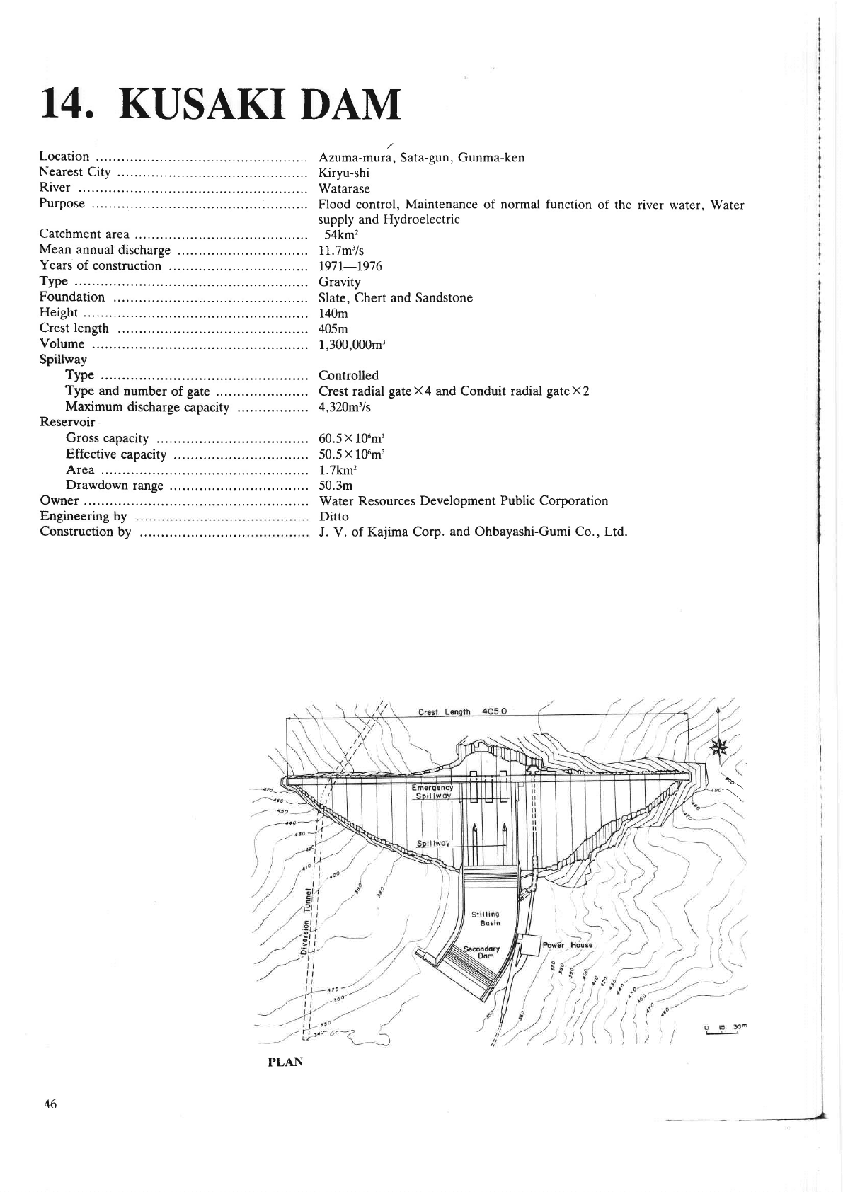
1. Geology
The dam
site
geology
consists mainly
of
paleozoic
slate
which
irregularly
includes chert
and is subject to metamorphism
by the intrusion of
granite
which
is
extensively
distributed in
the upstream-
In view of the dam {oundation, the
right bank
of the damsite
is of relatively favourable
quality without any/development
of fault.
There are, however,
some
faults in the
downstream
ponion
of the left bank.
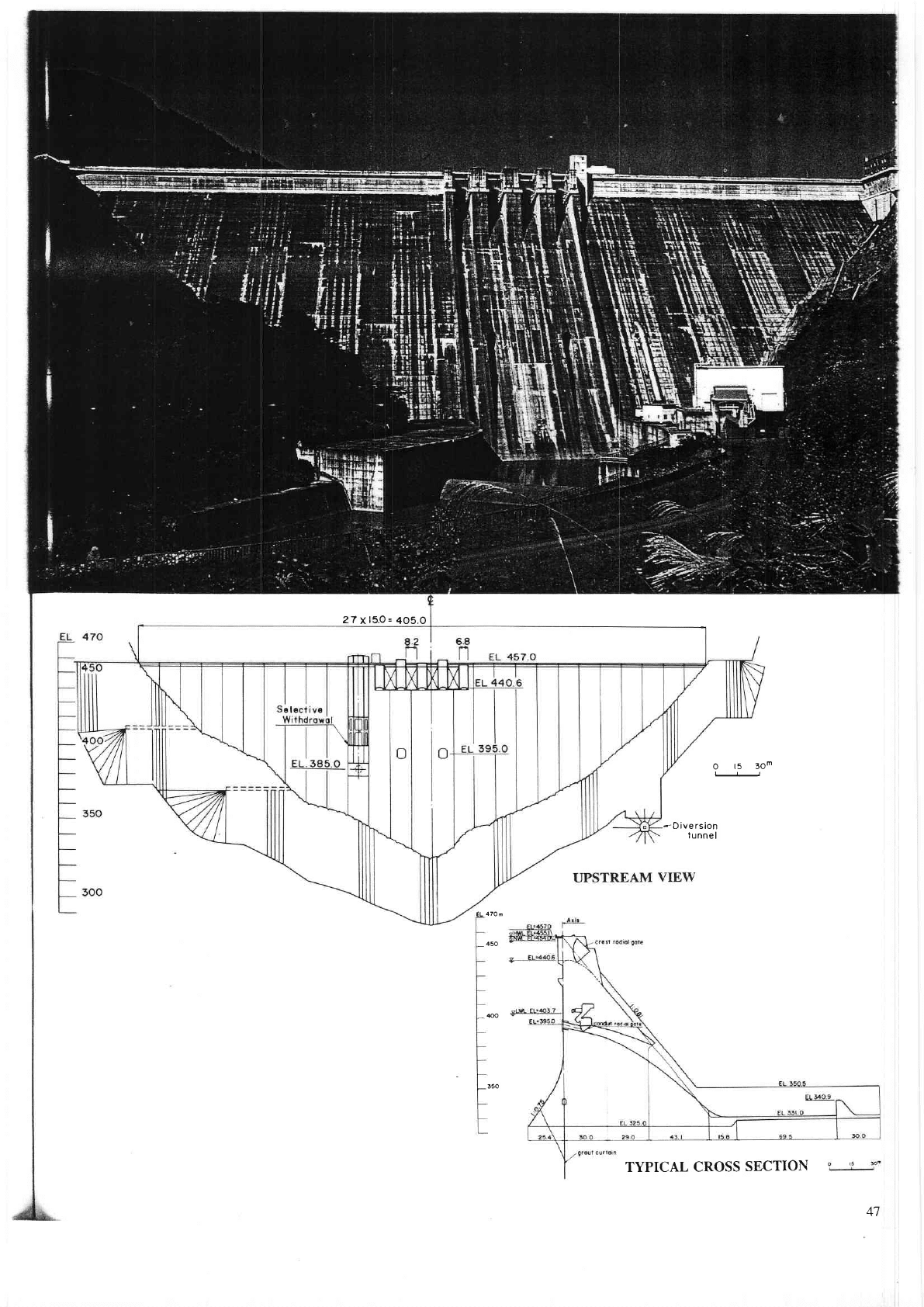
2. Desigr
The dam
is designed based
on the
two dimensional
stability
analysis
in mnsideration
of
geology, the dam materials,
and construction works, etc.
3. Foundation treatment
The consolidation
grouting
of 24,000m
and curtain
grouting of
47,000m
were carried out in the
foundation-
In execut-
ing the
grouting,
the dita obtiined
through
geological
investigations
in the
dam site, especially
the results of drilling
inves-
tigationl
permiability
tests and
grouting tests were comprehensively
examined.
For the improvement
of
the faults with a
high
permeability
which are
partially
developed
in the left
bank,
the
grouting
was also
carried out in the
grouting
tunnels
at
El. 375m and El. 414m.
The faults in downstream
portion
of the left abutment
was replaced
with mncrete
which was designed
by F.
E. M.
analysis to assure the safety
of the dam.
4. Construction
The dam conqete
placing
was
made in block
of 15m
wide and
35m
long with
one lift of 2m
which required
the artifi-
cial concrete cooling and
joint
grouting. Taking
into consideration
the
concrete
volume of 1,300,000m'for
the main
dam
and sub dam, topogiaphicconditions
oi the damiite
and construction
period,
etc.,
the dam concrete
placing was
performed
by using
a 20 ton oOi"t type cable
crane for
upstream
blocks
and a
travelling
jib
qane
for downstream
blocks-
The con-
crete
placing
took about
1200 days
for its completion.
5. Intake
The Watarase River has been
contaminated
for a
long time
by
the noxious
fumes
and foul discharges
coming
ftom
mp-
per
mining operation.
-
In orieito
preserve
the
water
quality in the
lower reaches
of the
river,
the dam
has been equipped
with a selective
in-
take with a semicircutar five-teaf
fixid
roiler
gate
to lvithdraw
water
from desired
depth
in the reservoir
and apparatuses
to
automatically
observe
the
lvater
quality
in the reservoir,
upstream
reaches
and tail race'
After the operation,
it was found
that
the water
intake
at
4m depth
is most
desirable.
Then the
actual
water intake
is
usually being m;de at this
water
depth under
automatic
control.
This
results
in an effective
prevention from
the intrusion
of heilry mJtals in water
to be discharged
and the
eutophication
of
the reservoir
as
well as maintcnance
of the
water
temperature at the level
required
for furigation.
f,
15.
MANAGAI4IA
DAM
Location
Nearest
City
.
River
Purpose
Catchment
area
Mean
annual
discharge
Years
of
construction
.
Type
Foundation
Height
Crest
length
Volume
Spillway
Type
Type
and
number
of
gate
Maximum
discharge
capacity
Reservoir
Gross
capacity
Effective
capacity
Area
Drawdown
range
Owner
Engineering
by
Construction
by
1.
Geology
The foundation
of Managawa dam
consists of
Palaeozoic Hida
gneiss,
which
involves limestone
in the shape of lens.
Gneiss
contacts with
sandstone, conglomerate and shale of Mesozoic Tedori
group
at the thrust
faults on immediate up-
stueam
of the
dam site. In addition, dikes
of
porphyrite
intrude these foundation rocks.
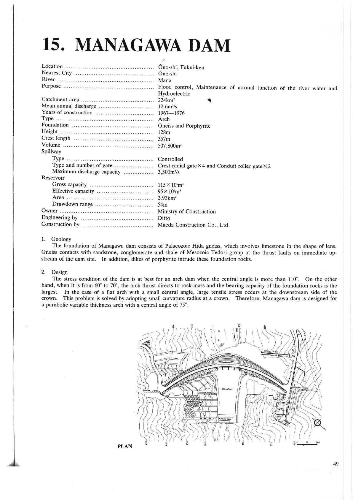
2. Design
The stress
condition of the dam is at
best for
an arch dam when the central angle
is more than 110". On the other
hand,
when it is
from 60' to 70', the arch thrust directs to rock mass and the bearing capacity
of the foundation rocks is the
largest.
In the case of a
flat arch
with
a small
central angle, large tensile stress occurs
at the downstream side of the
qown.
This
problem
is solved by adopting small curvatute
radius at a crown. Therefore,
Managawa dam is designed for
a
parabolic
variable thickness arch with
a central
ansle of ?5'.
i)(
Ono-shi. Fukui-ken
Ono-shi
Mana
Flood
control,
Maintenance
of
normal
function
of the
river
water
and
Hydroelectric
224km'z
i,
12.6m3ls
t967-r976
Arch
Gneiss and
Porphyrite
128m
357m
507,800m3
Controlled
Crest radial
gateX4
and
Conduit
roller gatexz
3,500m'/s
115
X
L0um3
95
X
106m3
2.93km'
54m
Ministry of
Construction
Ditto
Maeda
Construction
Co.. Ltd.
,i
PLAN
49

3. Foundation
treatment
The foundation
treatments
by
grouting
consist
Primary
consolidation
grouting was carried
out to
solidation
grouting
was carried
out
like a
fan from
foundation rocks
and to
prevent leakage
from
the
make impermeable zone in the
foundation
rocks.
of
primary
and
secondary
consolidation
grouting
and curtain
grouting.
improve
the
bearing
capacity
of
the foundation
rocks.
Secondary
con-
the fillet
of
the
downstream
side
to reinforce the
bearing capacity
of the
reservoir.
Curtain
grouting was carried out
from the upstream
fillet
to
4. Special foundation treatment
The special foundation treatment
was carried
out to
improve
safety of
the foundation rocks
along the
faults on the
right abutment. The frIst one
was a fault
treatment
tunnel,
which
was excavated
to
Prevent
seepage
percolating
along the
faults. The second one was
the treatment
works on
the right
shoulder
of the do*rrstream
which consist of
prestressing
of
rocks, concrete crib works and concrete
slub
revetment
and rock
ancher
works. The
third was fault treatment
works on
the right abutment of the up,stream,
which
consist of
concrete
slub
revetment
and rock ancher
norks. In addition,
the cor-
roded caverns of limestone were frlled
bv conqete
in amount
of
3,000ttt1.
TYPICAL CROSS
SECTION
50
16.
MIBORO
DAM
Location
Nearest
City .
River
Purpose
Catchment
area
Mean
annual
discharge
Years
of construction
.
Type
Foundation
Height
Crest length
Volume
Spillway
Type
Type
and
number
of
gate
Maximum
discharge
capacity
Reservoir
Gross
capacity
Effective
capacity
Area
Drawdown
range
Owner
Engineering
by
Construction
by
Shirakawa-mura,
Oono-gun,
Gifu-ken
Tonami-shi
Sho
Hydroelectric
399km'
42.9m'ls
t957-196r
Rockfill
Quartz-porphyry
131m
405m
7,950,000m'
Controlled
Crest roller
gateX 1,
Crest
drum
gateX
1
3,000m3/s
370X 106m3
330
X
10tn3
8.8km'
65m
Electric Power
Development Co.,
Ltd.
Ditto
Hazama-Gumi,
Ltd.
'.--,/--=
,1.-----1.-_,
-:-
-
LrlverSlOn I
PLAN
51

O
Excovotion
LirE
@
Inspeclion
Gollery
@
cor"
@
Fitter
O
Rockfill
@
RiproP
@
curtoin
Grout
TYPICAL
CROSS
SECTION
t%e;
.:l
-
-
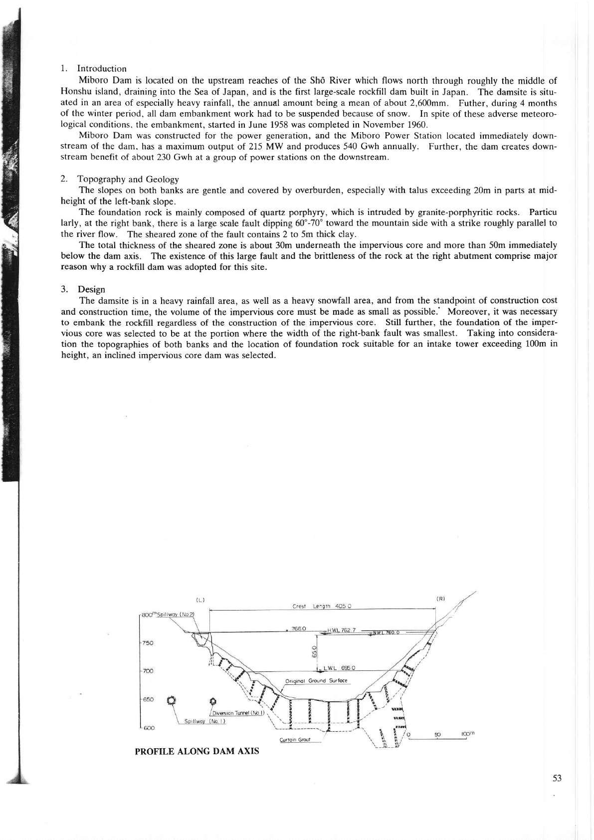
1. Introduction
Miboro
Dam is located on the upstreant
reaches of
the Shd River which flows
north through
roughly the middle of
Honshu
island, draining
into the Sea of Japan, and is the first
large-scale rockfill dam
built in Japan.
The damsite is situ-
ated
in an
area of especially heavy rainfall,
the annual amount
being a meari of about 2,600mm.
Futher, du ng 4 months
of the winter pe
od, all dam embalkment
work had to be suspended
because of snow.
In spite of these adverse meteoro-
logical
conditions.
the embankment, started in
June
1958 was completed in November 1960.
Miboro
Dam was constructed for the
power generation,
and the Miboro Power
Station located immediately down-
stream
of
the dam. has a
maximum output of 215 MW and
produces
540 Gwh annually.
Further, the dam creates down-
stream benefit
of about 230
Gwh at a
group
of
power
stations
on the downstream.
2.
Topography
and Geology
The slopes
on both banks are
gentle
and covered by
overburden, especially
with
talus exc€eding
20m in
palts
at
mid-
height
of
the left-bank slope.
The
foundation rock is mainly composed of
quartz
porphyry,
which is intruded by
granite-porphyritic
rocks.
Particu
larly,
at the right
bank, there is a large scale fault
dipping 60170" toward the
mountain
side
with
a strike roughly
parallel to
the river
flow. The
sheared
zone of the fault
contains
2 to 5m thick cla,
.
The total
thickness of the sheared zone is about 30m undemeath
the impervious core and more
than
50m immediately
below the dam
axis. The existence of this large fault and
the brittleness of the rock at the dght abutment comprise major
reason
why
a rockfill dam was adopted for this site.
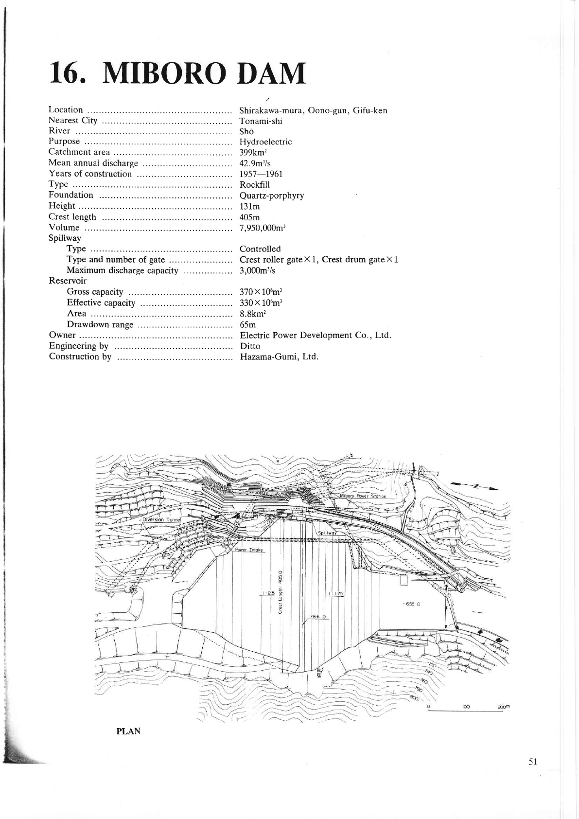
3. Design
The damsite
is in a heavy rainfall area, as
well as a heavy
snowfall area, and ftom the standpoint of construction
cost
and
construction
time, the
volume
of the impervious
core must be made
as small as
possible.'
Moreover, it was nec€ssary
to embank
the rockfill regardless of the construction of
the impervious core. Still further, the foundation of the
imper-
vious
core was
selected to be
at the
portion
where the
width of the right-bank fault was smallest. Taking into considera-
tion
the topographies
of both banks and the location
of foundation
rock suitable for an intake tower exc€eding
100m in
height, an inclined
impervious core dam
was
selected.
Clrloin
Grout
PROFILE
ALONG
DAM AXIS
Orioinol
Ground
Surfoce
53
4. Construction
4-1.
Materials
As rock
materials, granite
from a
quarry
2km upstream of the dam was mainly used,and
as suitable
cracks
were
de-
veloped
as a whole
there were
few cases requiring secondary crushing after blasting, and hard
and durable material with
a
suitable
mixture
of large and
small rock fragments w€re obtained.
Filter materials
consisted of a mixture of
sand,
gravel and cobbles deposited at the river
bed 3km
upstream of the darn
from which
sizes larger
than 200mm
were
removed by screening.
For impervious
core material, decomposed
granite
from a slope
facing
south at a
point
3km upstream
of the dam and
clayey
material
thickly distributed
at the foot of the slope
were blended at the borrow area.
The clayey
material, although
impervious,
was of high water
content,
while
the decomposed
granite,
although of high shear strength,
had a high
per-
meability,
and neither
one
was
suitable as an impervious core
material by itself. Accordingly,
decomposed
granite
was
used as the
main material with
clayey
material
colresponding
to abolut2oEo spread out in layers
in a stockpile.
4--2.
Embankment
Embankment
was completed in about 20 months under adverse meteorological conditions by mobilizing
heavy equip-
ment
and a maximum
of about 10,500m'/day and ar average of about 5,000mr/day were embanked.
Embankment
of rockfill was executed in lifts of 4m at th€
most, and
on
the downstream
rockfill,
in order
to reduce
settlement, water
was
sluiced
perpendicularly
onto the
slopes of the dumped rock. The
quantity
of water was more than
double
the rockfill banked,
and the
pressure was
not less than
skg/cm'! at the monitor nozzle.
Sluicing was not
performed
on
the upstream
rockfill.
The thickness
of lilter spread out
was
40cm, and
water was sprinkled to a degree that the mate
al
would
be saturated,
following which
compaction was done with 4
passes
of 50-t tire
rollers.
For impervious
core materials, 20-t sheep's foot rollers having
a crushing effect were used
for compaction, which
was
done
with
1.2
passes
of these
rollers on material
laid in thicknesses of 20cm. The
wat€r
content for compaction was in a range of
optimum
water conlentllVo. At
places
of
low elevation, lowering of the coefficient of
permeability
ftom that at the
beginning
of compaction
could be expected due to large
consolidation loads, while further, since these were locations from
where
it was
difficult to dissipate residual
pore pressures,
the
working water content was taken on the dry
side of optimum
water
content.
At the
upper
parts
the consolidation
loads were small and reduction in coefficient of
permeability
could not be
expected,
but on the other hand, since the width of the impervious
cote was small,
pore pressure
could
be easily dissipated and
work was
done with
water content on the
wet
side.
4-3. Foundation
Treatment
Two
grout
curtains
in the dver-bed,
and
one
grout
ortain each
in both abutments were executed
in the foundation of
the
impervious core.
For treatnent of the fault
zone at the right bank
a vertical
shaft
of depth
of 60m
was provided
next to
the
fault, and
grouting
was done ftom three adits branching
from this shaft. Cement and chemical
grouts
were used
in
combination,
and
grouting
was done in the vertical and horizontal
directions, the
grouting
in tlle horizontal direction being
pa
icularly
effective.
5.
On August 19,
1961, one
year
after start of
filling at Miboro
Dam and approximately in the
second month after
reaching
normal water
level,
the
Kitamino Earthquake
(M:7.2) vrith its epicenter at a
point
1.7km southwest of the damsite
occurred. The
acceleration at the damsite was estimated
to have beeD about 0.1g,
which was
lolv compared with the design
seismic
coefficient of
0.12. The
dam showed settlement of
approximately 5cm due to this earthquake, and there was a
movement
of approximately
3cm to the
downstream side, but otherwise,
nothing abnormal happened. Further, on September
9, 1969. the
Okumino Earthquake
(M:6.6)
occuned
with the epicenter approximately
40km
from the dam. The maximum
acceleration
at the foundation was estimated to have been
approximately 0.089, but
no influence
was recognized in th€
dam.
The settlement
of the
dam crest at the maximum section
reached 33.9cm in the first
year
and 42.6cm in the s€cond
year,
while
the horizontal
movement in the
downstream direction reached
39.4cm in the first
year
and 41.7cm in
the second
year,
and
the same
trends were indicated as for lvater level
variations. Both settlement and horizontal movement stabilized after
the
fifth
year
to cease
at 69cm
(O.55Va
of dam height)
and 55cm
(0-44Vo
of
dam height), respectively.
Pore pressures
immediately
after
completion of embankment
were
about 1570 of total load, a small value compared
with
the design value.
6. Power
Generating Facilities
A maximum
of 130m3/sec of
water
is conducted
from an intake
structure of height of 90m having a caterpillar
gate (height
8.6m
x
midth
5.5m) located at the left bank 200m upstream
ftom the
dam, through a circular
pressure
tulnel of
inside diameter
of 6;0m and length
of 93.0m, which feeds two
penstocks
of inside
diameter of
6.0m
and length
of 33.7m, each. Utilizing
an
effective
head of 192.1m
at an underground
powerhouse
of
width of 22.5m, height of
47.8m
and length of 77m, a maximum
of
215
MW is
generated
by two
vertical Francis turbines and
generators. Water
discharged from the
powerhouse
is
released into
Hatogaya
Reservoir
(Kansal
Electric Power Co., Inc.)
on the downstream
through a horseshoe-shaped non-pressure tunnel of
inside
diameter of
7.2m and leneth of 8.939.8m.
54
T7.
MIHO DAM
Location
Nearest
City
.
River
Purpose
Catchment
area
Mean
annual
discharge
Years
of
construction
.
Type
Foundation
Height
Crest
length
Volume
Spillway
Type
Type and
number of
gate
Maximum
discharge capacity
Reservoir
Gross capacity
Effective
capacity
Area
Drawdown
range
Owner
Engineering
by
Construction
bv
Yamakita-cho,
Ashigarakami-gun, Kanagawa-ken
Odawara-shi
KOchi
Flood control,
Water supply and Hydroelectric
159km'
11.0m3/s
r974-1.978
Rockfill
Green
tuff
95m
588m
5,816,000m',
Controlled
Crest
radial
gateX4 and Crest
fixed roller
gateX
1
3,1,00m3/s
64.9x
Lffm3
54.5
X
106m3
2.Zkm'z
39.2m
Kanagawa-ken
Ditto
Kajima
Corp.
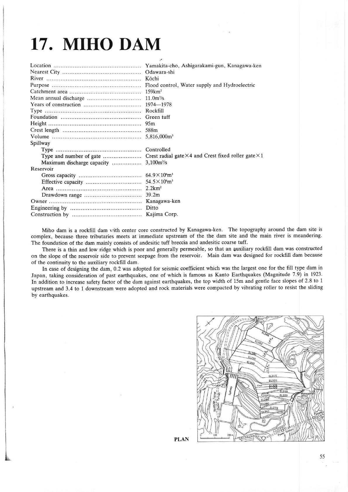
Miho dam
is a rockfill
dam vith center core
constructed
by Kaaagawa-ken.
The topography
around the dam site
is
complex,
because three tributaries meets
at immediate
upstream
of the the
dam site and the main river
is meandering.
The
foundation of the dam mainly consists
of andesitic
tuff breccia
and andesitic
coarse tuff.
There is a thin and low ridge
which is
poor
and
generally
permeable,
so that
an
Suxiliary
rockfill dam
was constructed
on
the slope of the reservoir side
to
prevent
seepage
from the
reservoir.
Main dam
was
designed
for rockfill
dam becaus€
of the continuity
to the auxiliary
rockfill dam.
In case
of designing the
dam, 0.2 was adopted
for seismic
coefficient
which was the largest one
for the fill type
dam in
Japan, taking
"onsidetitiott
of
past
earthquakes,
one
of
which is famous
as Kanto Earthquakes
(Magnitude
7 .9) h 1923-
In addition to increase
safety
factor of the
dam agaimt
earthquakes,
the
top width
of 15m and
gentle
face slopes
of 2.8
to 1
upstueam
and 3.4 to 1 downstream
were adopted
and
rock materials
were compacted by
vibrating roller to resist
the sliding
by earthquakes.
PLAN
55
