George W. Stimson introduction to Airborne Radar (Se)
Подождите немного. Документ загружается.

Strategic Bombing
557
Each of the bomber’s three
crew members has the equiva-
lent of simultaneous indepen-
dent use of different modes
through their own displays.
Given the coordinates of a
check point, the radar makes
a patch map centered on it
and turns off.
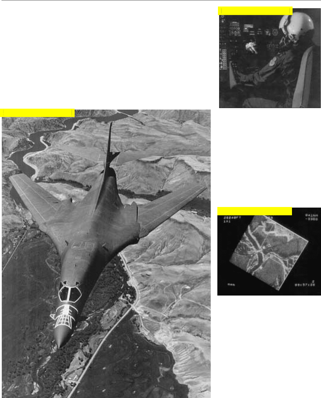
The B-1B not only looks like a fighter, but its radar employs key hardware technology trans-
ferred from the radar for the F-16 C/D.
path that are higher than a selected
ground clearance plane, enabling the
pilot to maintain the lowest possible
overall altitude.
Weapon Delivery. For weapon
delivery—both conventional and
nuclear —high-resolution SAR map-
ping is used as just described. In
addition, a ground-beacon tracking
mode and a ground-moving-target-
tracking mode enable precise target-
ing of both fixed and moving targets.
Because of the extreme flexibility
of electronic beam steering, several
radar modes can be sequentially time-
shared, giving the pilot, copilot, and
offensive systems officer (OSO) the
equivalent of simultaneous indepen-
dent use of different modes through
their own displays.
Click for high-quality image
Click for high-quality image
Click for high-quality image
558
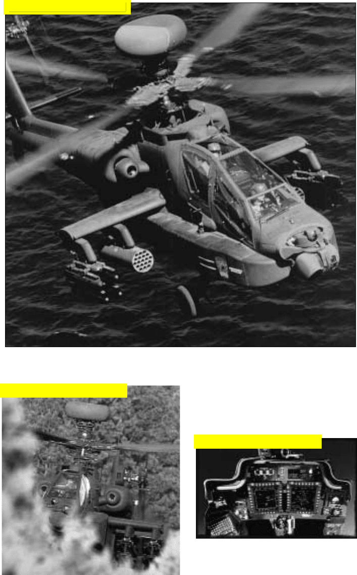
The AH-64D carries up to 16 RF or semi-active laser-guided Hellfire missiles and 76 70-mm fold-
ing fin aerial rockets or a combination of both, and up to 1,200 rounds of 30-mm ammunition
AH-64D Apache Helicopter
(Longbow Radar)
Longbow is a fast-reaction, low-
exposure, high-resolution, millimeter-
wave fire-control radar designed for
the AH-D Apache attack helicopter.
Mounted atop the main rotor mast to
take advantage of terrain masking, the
radar can pop up and, in seconds
scan a 90° sector; then, drop down
out of sight.
During that brief interval, it can
detect, classify, and prioritize more
than 100 moving and stationary
ground targets, fixed wing aircraft, and
both moving and hovering heli-
copters—discriminating between
closely spaced targets of the same type
with an extremely low false-alarm rate.
It then displays the 10 highest
priority targets to the aircrew, and will
automatically cue either an RF or a
semi-active laser guided fire-and-for-
get Hellfire missile to the first target.
Immediately after its launch, the sys-
tem cues the next missile to the next
priority target, and so on.
The radar also provides obstacle
warning to alert the pilot to naviga-
tion hazards, including man-made
structures, towers, etc.
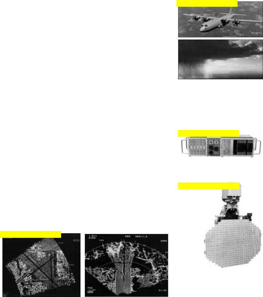
Radar data is displayed on the
pilot’s night-vision helmet-mounted
display and on two color-coded flat
general purpose displays in each
cockpit.
A derivative of the Longbow
radar will be forthcoming for the
RAH-66 Comanche helicopter. Using
the same millimeter radar and the
same Hellfire missiles as Apache, it
will include a number of advanced
features such as a smaller antenna.
Attack Helicopter
Lurking behind cover with only the radome of
its millimeter wave radar showing, Longbow
can quickly detect, classify, and prioritize
more than 100 moving or stationary targets.
Flat, fully interchangeable
color displays are provided in
both cockpits.
Click for high-quality image
Click for high-quality image
Click for high-quality image
559
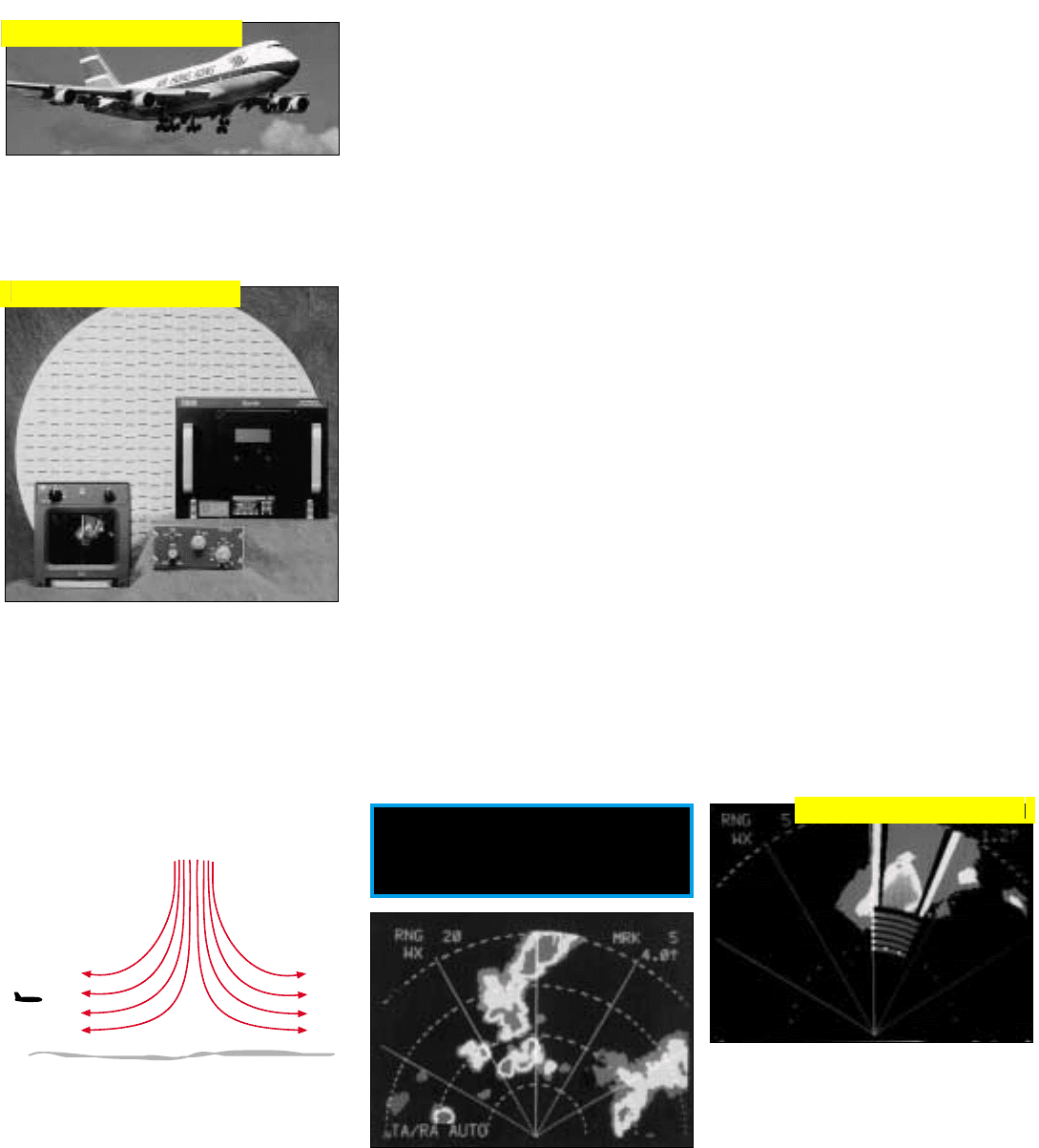
C-130 (APN-241)
Meeting all of the requirements of
tanker/transport operations, the APN-
241 is the baseline radar for the C-
130J. It also can be employed in a
number of other aircraft, when exist-
ing modules that interface with their
avionics, controls, and displays are
included.
Implementation. A light-weight
X-band coherent pulse-doppler radar,
the APN-241 consists of just two
basic elements: an antenna and a
receiver-transmitter-processor.
The antenna is a 26 by 32-inch,
dual-channel, monopulse planar
array. Stabilized about three axes, it
provides ±135° of azimuth coverage
and +10 to
–
25° of elevation coverage.
The receiver-transmitter-processor
is all solid state. Operating at 9.3 to
9.41 GHz, it has a power output of
116 W peak; 9.5 W, average.
Modes of Operation. To meet all-
weather delivery requirements, a vari-
ety of modes are provided:
• Weather—detects weather
through weather, out to 320
nmi; turbulence out to 50 nmi
• Windshear detection—gives up
to 90 seconds of warning of a
microburst (probability of false
alert <10
-4
per flight hour)
• Ground mapping—monopulse
(2.5 to 10 times improvement
over real beam); DBS, for higher
resolution mapping off the nose
• Air-to-air detection—20 nmi
against a C-130-sized target;
indicates whether nose or tail
aspect
Overlay Modes
• Beacon—interrogates both air
and ground beacons
• Station-keeping
• Flight plan—navigation data
from self-contained navigation
system or other reference
1
• Traffic collision avoidance sys-
tem (TCAS)
1
The radar is designed for two-per-
son cockpit operation. Pilot and navi-
gator can view and control different
modes simultaneously.
Growth. A SAR mode has already
been developed and is available as a
software update. In development are
terrain following, drop-zone wind
measurement, and autonomous land-
ing guidance modes.
C-130J
Transport/Tanker Navigation
APN-241 can map weather
out to 320 nmi, turbulence
to 50 nmi, and give 90-sec-
ond windshear warning.
Receiver-Transmitter-Proces-
sor, includes interfaces for
aircraft avionics, controls,
and displays
The 26 x 32-inch dual-
channel antenna pro-
vides ±135° azimuth
coverage and is space
stabilized about all
three axes.
DBS ground map (far left) enables precise location
of drop zones or target areas.
Monopulse ground map (left) enables blind radar
approaches to small or unimproved landing sites.
1. Can be displayed auto-
nomously or overlaid
on any radar map.
Click for high-quality image
Click for high-quality image
Click for high-quality image
Click for high-quality image
560
The RDR-4B is currently oper-
ating in nearly every type of
commercial transport aircraft.
RDR-4B Civil Weather Radar
The RDR-4B is a pulse-doppler
forward-looking weather radar, oper-
ating in nearly every type of commer-
cial transport aircraft. Besides the
ability to penetrate weather systems
and accurately map rainfall and tur-
bulence, it meets all FAA require-
ments for stand-alone windshear
detection.
At altitude, the radar provides a
detailed ground-clutter-free color
weather display of a ±40° forward
sector out to a selectable maximum
range of up to 320 nmi.
Whenever the absolute altitude is
less than 2,300 feet, the windshear
detection mode is automatically acti-
vated on alternate antenna scans.
1
During clockwise scans, the radar
continues to operate in the operator
selected mode. But during counter-
clockwise scans, it operates in winds-
hear mode, with the antenna tilt tem-
porarily changed to the optimum
angle for measuring horizontal winds
caused by the outflow from a
microburst core. The only apparent
difference in the radar’s operation,
though, is that the display updates
only on the clockwise scans.
If a windshear is detected at any
range out to 5 nmi, an advisory icon
appears on the display, and a chime
or oral caution, “monitor radar dis-
play” sounds.
Below 1500 feet, if a windshear is
detected within 3 nmi and ± 25° of
the aircraft’s heading, a windshear
alert, sounds, and a warning appears
on the radar display.
At 1.5 nmi, a windshear icon
indicating the exact location of the
microburst is superimposed over the
normal display, and an oral warning,
“windshear ahead, windshear ahead”
sounds,
2
giving the pilot roughly 15
seconds to avoid the potential hazard.
Civil Applications
Antenna, radar electronics,
controls, and display unit.
Pulse width:
radar modes, 6
and 18 µsecs (interlaced);
weather, 2 µsecs.
PRF:
weath-
er and maps, 380 Hz; turbu-
lence mode, 1.6 kHz; wind-
shear mode, 6kHz.
Peak
transmitter power:
125 W.
Frequency agility for interfer-
ence reduction.
When windshear is encoun-
tered, red and yellow icon is
superimposed over the weath-
er display, indicating the
microburst’s exact position.
Standard Weather Display
■ Level 2 rain ■ Level 4 & above
■ Level 3 rain ■ Turbulence
In windshear mode, antenna tilt is temporarily
changed to the optimum for measuring the hor-
izontal winds due to the out flow from a
microburst.
1. If the radar isn’t already on,
it automatically turns itself
on and operates continu-
ously in windshear mode.
2. During landing, this would
be changed to “go around,
windshear ahead.”
Click for high-quality image
Click for high-quality image
Click for high-quality image
Civil Applications
561
HISAR
This is an advanced high-resolu-
tion, real-time radar mapping system
developed for a wide range of primarily
civil uses. It can monitor environmental
conditions such as flood damage, oil
spills, and sea ice over vast regions in
inclement weather. It can uncover ille-
gal activities and detect illegal border
crossings and threatening buildups
without provoking a response.
Implementation. Suitable for use
in small executive-class aircraft, HISAR
consists of an X-band, multimode
radar which looks out through a
radome in the bottom of the aircraft,
plus a computer workstation which
controls the mission and displays the
radar’s outputs to the operator.
The radar has two planar array
monopulse antennas mounted back-
to-back. When aligned with the flight
path, they enable surveillance to be
switched quickly from one side of the
aircraft to the other.
The workstation has two displays:
one for mission planning and control;
the other, for displaying SAR images
and target data. A second workstation
may be installed in a ground facility,
enabling preflight mission planning and
post-flight analysis to be performed
there rather than in the aircraft.
Mission Control. For radar and
mission control, the aircraft’s GPS-
aided INS provides HISAR with the air-
craft’s longitude, latitude, velocity, alti-
tude, and attitude. To guide the aircraft
on its mission, HISAR’s workstation
gives the autopilot flight commands. To
collect the desired data at appropriate
points in the preplanned mission, it
cues the radar’s selection of modes and
controls their operation. At any point
in the mission, of course, the radar can
be redirected by the operator.
Radar Modes. Imaging is per-
formed in three of HISAR’s five radar
modes:
• Wide-area search (DBS)—radar
scans a 60° sector extending from
37 km to 110 km with resolution
of 25 meters in range and 0.4
milliradian in azimuth
• SAR strip map—strip 37 km
wide can be positioned in range
anywhere between 20 and 110
km; resolution of 6 meters in
both range and azimuth
• SAR spotlight—patch 3.5 km
square, with 1.8 meters resolution
in azimuth and elevation, can be
placed anywhere in range be-
tween 37 and 110 km and in
azimuth within ±45° off broadside
Supplementing these modes are
(a) ground-moving target detection
which can be interleaved with wide-
area-search and strip-map modes, and
(b) air-to-air search. The latter is a
coherent low-PRF mode providing
±150° coverage in two elevation bars.
It is capable of detecting helicopters
and low-level, medium-speed aircraft
out to a range of 70 km, enabling the
operator to monitor the “air picture”
over an immense area.
Multisensor Integration. HISAR is
integrated with and exchanges cueing
and data with a forward-looking
infrared sensor (FLIR) and communi-
cation and electronic-intelligence sen-
sors.
HISAR antenna looks out
through radome in the bottom
of this executive-class aircraft.
Radar has two planar array
antennas mounted back-to-
back on an azimuth gimbal.
Long-wavelength FLIR images cued by HISAR: truck convoy (above, left), and tanker
trucks (above, right). Note white image of wheels produced by heat of the tankers’ tires.
The operator’s workstation
has two large displays. One
(top) for mission planning and
control; the other for SAR
images and target data.
Click for high-quality image
Click for high-quality image
Click for high-quality image
Click for high-quality image
Click for high-quality image

562
RADAR SYSTEMS COVERED
RADAR DEVELOPER
APS-145 Lockheed Martin
APY-1/2 Northrop Grumman
ESSD*
(Westinghouse)
JointSTARS Northrop Grumman
Norden Systems
APG-77 Joint venture:
Northrop Grumman
Raytheon TI Systems
APG-68 Northrop Grumman
ESSD*
(Westinghouse)
APG-73 Raytheon
(Hughes)
APG-76 Northrop Grumman
Norden Systems
APQ-181 Ratheon (
Hughes)
APQ-164 Northrop Grumman
ESSD*
(Westinghouse)
Longbow Joint venture:
Lockheed Martin
Northrop Grumman
APN-241 Northrop Grumman
ESSD*
(Westinghouse)
RDR-4B Allied Signal
HISAR Ratheon
(Hughes)
*ESSD – Electronic Sensors & Systems Division
547
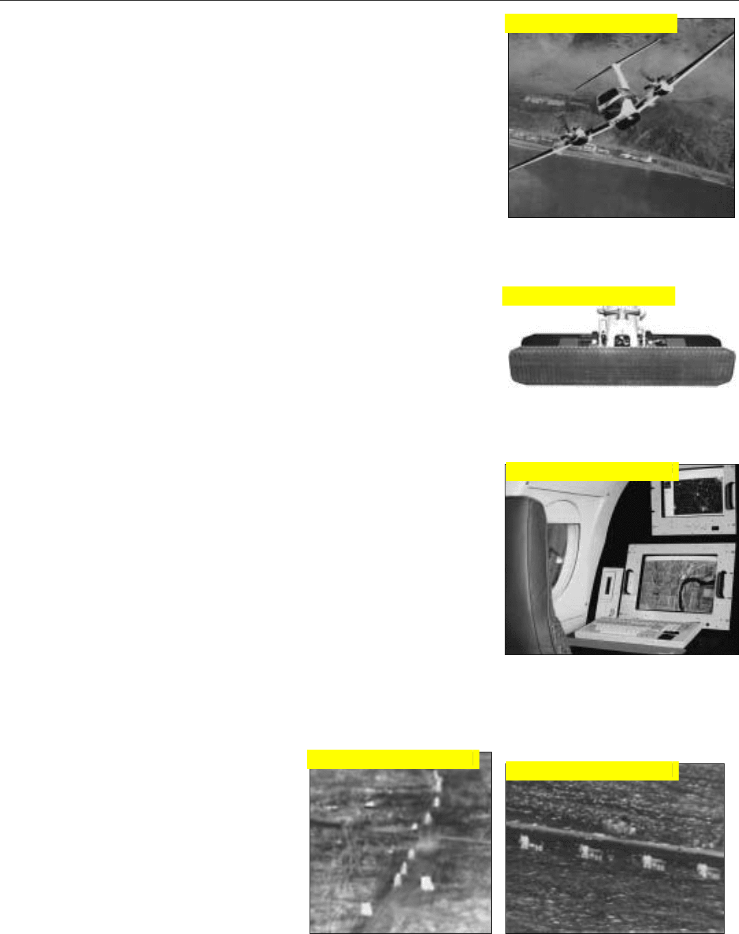
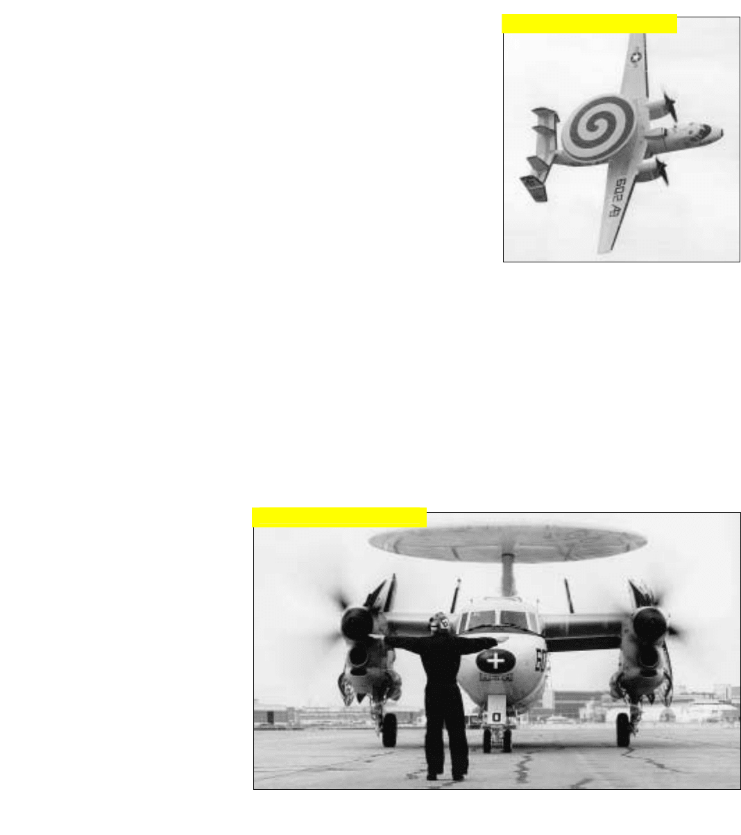
E-2C Hawkeye
The APS-145 is the latest version
of the Airborne Early Warning radar
for the US Navy’s carrier based E-2C
Hawkeye. Early versions of the aircraft
went into service in 1963. Since then,
it and the radar have undergone
numerous upgrades.
Designed for operation over both
land or sea, the APS-145 can provide
surveillance over 3,000,000 cubic
miles of air space and can simultane-
ously monitor and track up to 2,000
targets. Looking beyond the horizon,
it has a maximum detection range of
350 nmi.
Implementation. Operating at
UHF frequencies (0.3 to 1.0 GHz) to
minimize sea clutter, the radar employs
a linear array of yaggi antennas, having
monopulse sum and difference out-
puts. This array is housed in a 24-
foot-diameter rotating radome, called a
rotodome, which rotates at 5 rpm.
The transmitter is a high-power
coherent master-oscillator power-
amplifier (MOPA). It is switched
through three different PRFs to elimi-
nate doppler blind zones and employs
linear frequency-modulation (chirp)
pulse compression.
Adaptive Signal Processing. By
means of DPCA and a double-delay
AMTI clutter canceller, mainlobe clut-
ter is eliminated, thereby avoiding the
problem of low-closing (or opening)
rate targets being obscured by spread-
ing of the clutter spectrum due to the
aircraft’s advance when looking in
broadside directions (normal to the
aircraft velocity). Clutter cancellation
is followed by coherent signal integra-
tion with the FFT. To minimize false
alarms, the detection threshold is
adaptively adjusted—resolution-cell
by resolution-cell—in accordance
with the clutter level and the density
of targets.
DPCA. The phase center of a side-
looking planar array can be displaced
forward or aft in the plane of the array
by adding or subtracting a fraction of
the monopulse difference signal, in
quadrature, from/to the sum signal.
In the E-2C, following transmission
of the first pulse of each successive pair
of pulses, the phase center is displaced
forward by the distance the aircraft will
advance during the interpulse period.
Following transmission of the second
pulse, the phase center is displaced aft
by the same amount. As a result, both
pulses will travel the same round-trip
distance to any point on the ground,
Reconnaissance & Surveillance
Carrier-based E-2C Hawkeye
can monitor 3,000,000 cubic
miles of airspace and simulta-
neously track 2,000 targets.
Hawkeye’s 24-foot diameter rotodome houses a monopulse connected linear array of UHF
yaggi antennas, and rotates at 5 rpm.
making possible complete cancella-
tion of the ground return by the clut-
ter canceller.
This process, of course, requires
precise synchronization with the
PRF, the velocity of the aircraft, and
the rotation and look angle of the
antenna.
Click for high-quality image
Click for high-quality image
PART X Representative Radar Systems
548
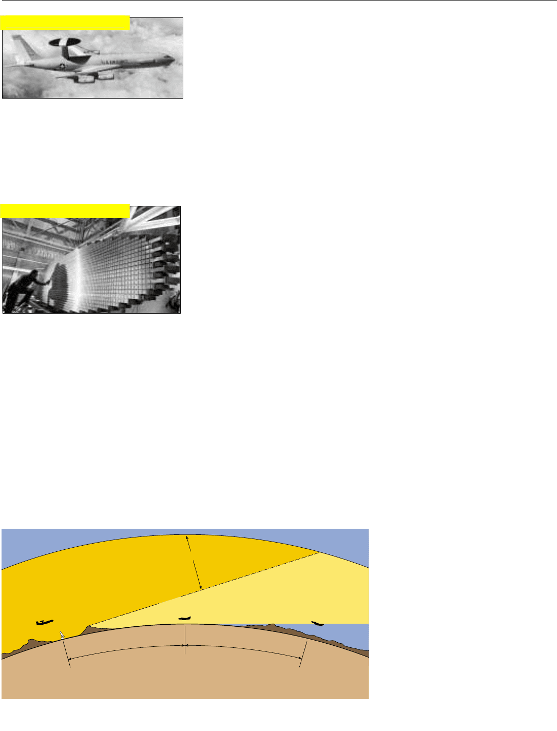
E-3 AWACS Radar
The APY-2 is the radar for the
U.S. Air Force E-3 Airborne Early
Warning and Control System
(AWACS). From an operational alti-
tude of 30,000 ft, the radar can detect
low altitude and sea-surface targets
out to 215 nmi, coaltitude targets out
to 430 nmi, and targets beyond the
horizon at still greater ranges.
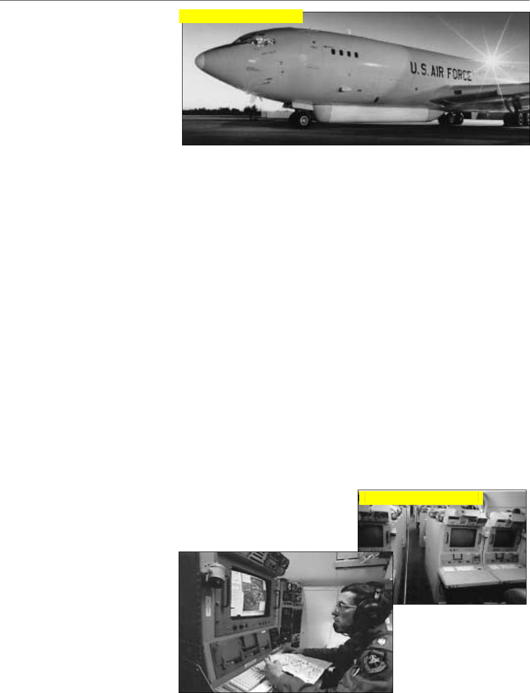
Implementation. Operating at S-
band frequencies (nominally 3 GHz),
the radar employs a 24-ft by 5-ft pla-
nar-array antenna, steered electroni-
cally in elevation, and housed in a
rotodome which rotates at 6 rpm.
Besides phase shifters for eleva-
tion beam steering, phase shifters are
also provided for offsetting the beam
for reception during elevation scan-
ning to compensate for the time delay
between transmission of a pulse and
reception of returns from long-range
targets. The antenna has an extremely
narrow azimuth beamwidth and is
amplitude weighted for sidelobe
reduction.
The transmitter chain consists of
a solid-state predriver—whose output
power is increased as a function of
antenna elevation angle—a TWT
intermediate power amplified, and a
high-power pulse-modulated dual-
klystron amplifier. For reliability, dual
redundancy is employed throughout.
Following an extremely low-noise
(HEMT) receiver preamplifier, two
separate receive channels are provid-
ed: one for range-gated pulse-doppler
operation; the other, for simple
pulsed-radar operation.
Digital processing is performed by
a signal processor, employing 534
pipeline gate arrays operating at 20
MHz; and a data processor, employ-
ing four RISC CPUs.
Modes of Operation. The radar
has four primary modes of operation:
• High-PRF pulse-doppler range-
while-search, for detecting targets
in ground clutter;
• High-PRF pulse-doppler range-
while-search, plus elevation scan-
ning for additional elevation
coverage and measurement of
target elevation angles
• Low-PRF pulsed radar search with
pulse compression, for detecting
targets at long ranges beyond-
the-horizon, where clutter is not
a problem
• Low-PRF pulsed radar search for
detecting surface ships, featuring
extreme pulse compression and
adaptive processing that adjusts
for variations in sea clutter and
blanks land returns on the basis
of stored maps.
These modes can be interleaved
to provide either all-altitude long-
range aircraft detection or both air-
craft and ship detection. A passive
mode for detecting ECM sources is
also provided.
Each 360° azimuth scan can be
divided into up to 32 different sec-
tors, in each of which a different
operating mode and different condi-
tions can be assigned or changed from
scan to scan.
215 nmi
(400 Km)
215 nmi
(400 Km)
LIMIT OF AWACS
SURFACE TARGET
COVERAGE
LIMIT OF AWACS
COALTITUDE
TARGET COVERAGE
AWACS
30,000 ft
GROUND RADAR COVERAGE
AWACS RADAR SURVEILLANCE VOLUME
SEEN ONLY BY AWACS
AWACS installed in an E-3.
The AWACS antenna consists
of a stacked array of 28 slot-
ted waveguides, plus 28 reci-
procal ferrite elevation-beam-
steering phase shifters and 28
low-power nonreciprocal
beam offset phase shifters.
From an altitude of 30,000 ft., AWACS can detect sea and low-altitude targets out to 215 nmi
and coaltitude targets out to 430 nmi.
Click for high-quality image
Click for high-quality image
Joint STARS
Joint STARS is a long-range, long-
endurance, air-to-ground surveillance
and battle management system carried
aboard the U.S. Air Force E-8C air-
craft. Operating at altitudes up to
42,000 feet, the system’s high-power
pulse-doppler radar is capable of
looking deep behind hostile borders
from a stand-off position and monitor-
ing fixed and moving targets with a
combination of high-resolution SAR
mapping and moving-target indication
(MTI) vehicle detection and tracking.
Implementation. The radar em-
ploys a 24-foot-long, roll-stabilized,
slotted-waveguide, side-looking pas-
sive ESA, housed in a 26-foot-long
radome carried under the forward sec-
tion of the fuselage. The antenna is
steered electronically in azimuth and
mechanically in elevation.
Digital processing is performed by
multiple signal processors. The radar
data and signal processors are con-
trolled by a VAX-based distributed
processing system that includes indi-
vidual digital processors at each of 17
operator work stations and one navi-
gator/operator work station. All are
readily accommodated in the E-8C’s
140-ft-long cabin.
To separate targets having very low
radial speeds from the accompanying
mainlobe clutter, the displaced phase
center technique described in Chap.
24 is used. To enable the targets’ angu-
lar positions to be precisely deter-
mined, the antenna is subdivided
lengthwise into three segments, also as
described in Chap. 24.
Modes of Operation. The radar
has three primary modes of operation:
• High-resolution SAR imaging,
for detecting and identifying sta-
tionary targets
• Wide-area MTI surveillance, for
situation awareness
• Sector MTI search, for battle-
field reconnaissance.
As the name implies, the MTI
modes are used to locate, identify, and
track moving targets. When a vehicle
that is being tracked stops, the radar
can almost instantly produce a high-
resolution SAR image of the vehicle
and the surroundings.
All three modes may be flexibly
selected or interleaved.
Targets detected with MTI are dis-
played as moving images. These can
be superimposed on digitally stored
maps or on the radar’s SAR maps.
And they can be stored and replayed
at selectable speeds.
An operator can individually dis-
tinguish the vehicles in a convoy, even
determine which vehicles are wheeled
and which are tracked. If a vehicle
stops, a SAR map showing it and the
immediately surrounding area can be
almost immediately produced.
Encrypted, the radar data may be
relayed by a highly jam-resistant data
link to an unlimited number of Army
ground control stations.
Reconnaisance & Surveillance
549
Three-segment passive ESA,
electronically steered in azi-
muth and manually steered in
elevation, is housed in the 26-
foot-long radome under the for-
ward section of the fuselage.
Navigator’s workstation (left) is
one of 18 operator workstations.
Each is equipped with a digital
processor which is included in
Joint STARS’ VAX-based distrib-
uted processing system.
Click for high-quality image
Click for high-quality image
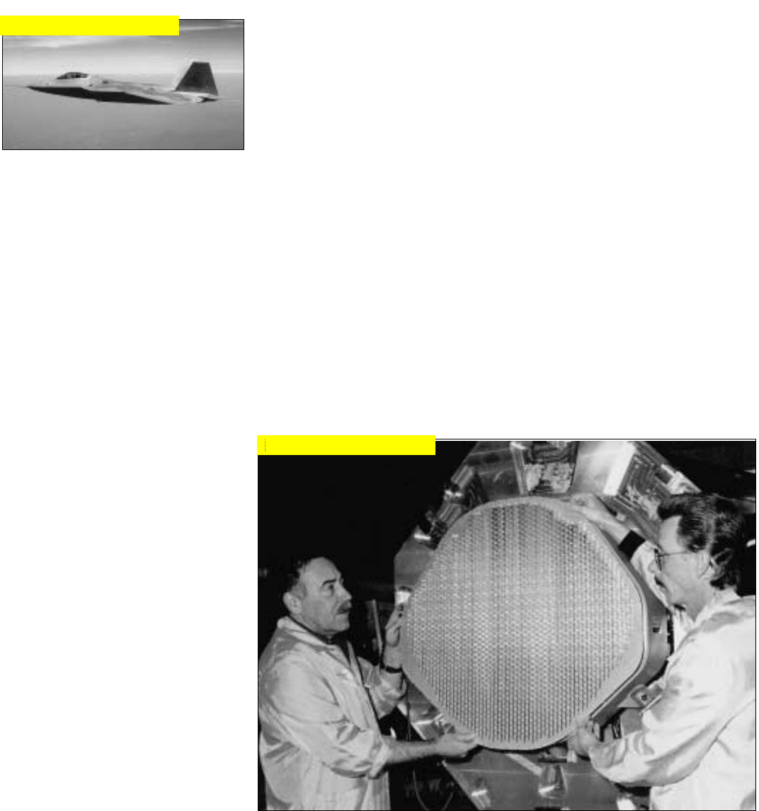
F-22 Stealth Fighter
F-22 (APG-77)
The APG-77 is a multimode
pulse-doppler radar meeting the air
dominance and precision ground
attack requirements of the F-22
stealth dual-role fighter. It may be
armed with six AMRAAM missiles or
two AMRAAMs plus two 1,000-
pound GBU-33 glide bombs, two
sidewinder IR missiles, and one 20-
mm multi-barrel cannon—all of
which are carried internally for low
RCS. Four external stations are also
available to carry additional weapons
or fuel tanks
At present, very little can be said
at an unclassified level about the
radar other than that it employs an
active ESA, that it incorporates exten-
sive LPI features, and that its signal
and data processing requirements are
met by a common integrated proces-
sor (CIP).
The active ESA provides the fre-
quency agility, low radar cross-sec-
tion, and wide bandwidth required
for the fighter’s air dominance mis-
sion.
Two CIPs perform the signal and
data processing for all of the F-22s
sensors and mission avionics, with
processor elements of just seven differ-
ent types. One serves the radar, elec-
tro-optical, and electronic warfare sub-
systems; the other, the remaining
avionics. Both have identical back
planes and slots for 66 modules.
Initially only 19 slots were filled in CIP
1 and 22 in CIP 2, leaving room for
200% growth in avionics capability.
Fighter & Attack
550
The active ESA employed by the APG-77 to meet low RCS requirements provides extreme
beam agility and supports enumerable growth features.
Click for high-quality image
Click for high-quality image